La Garita Caldera

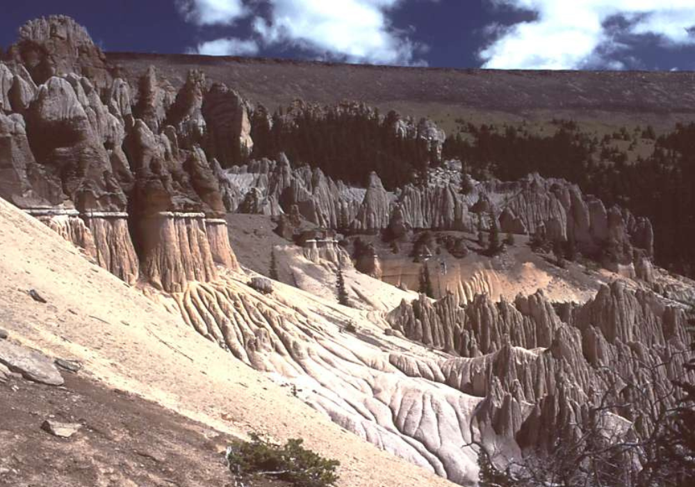
Mount St. Helens’ eruption in 1980 is the reference point for most Americans’ familiarity with volcanoes. As destructive as that was, it was just a blip compared to an event in the San Juan Mountains some 28 million years ago. The La Garita Caldera eruption was one of the three most destructive volcanic events in Earth’s history. It released ten thousand times as much debris as Mount St. Helens. Temperatures rose to fifteen hundred degrees, and the Four Corners area was obliterated. All that remained was a yawning red-hot gash on the landscape [the size of Mineral County]. Eventually it cooled. And today, near Creede, you can see the twenty by fifty mile depression it left behind: the La Garita Caldera. That slowly collapsed and formed stark columns and smooth cascades. Over millennia, these became the fascinating rock structures of the Wheeler Geologic Area, and that became Colorado’s first national monument in 1908.

About Colorado Postcards
Colorado Postcards are snapshots of our colorful state in sound. They give brief insights into our people and places, our flora and fauna, and our past and present, from every corner of Colorado. See more postcards.