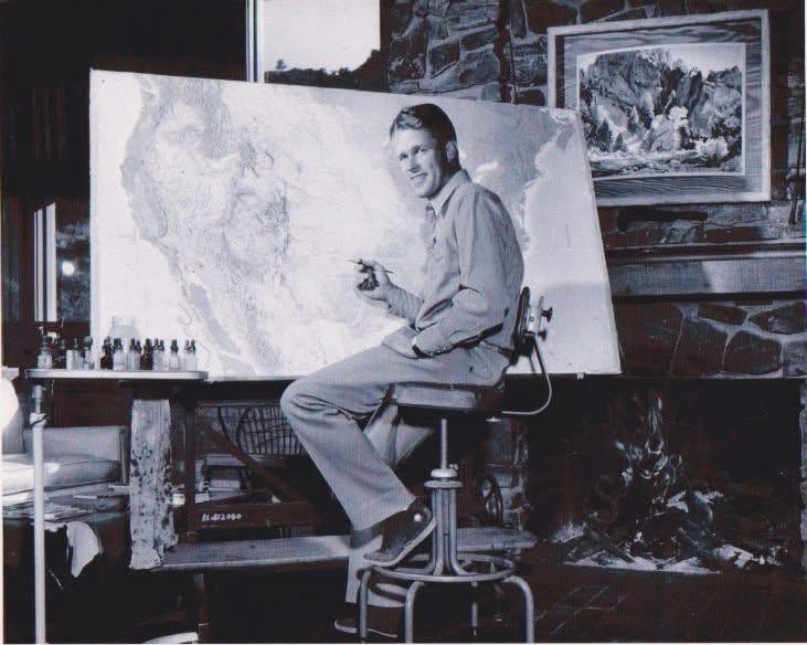
Hal Shelton and ski maps
Bunny slopes to black diamonds — a Colorado artist gave us a better way to get down mountains. Hal Shelton felt maps should look like what you see. In the 40s, he made maps for the Air Force, with color and shading to create the realism of satellite images — before satellites! Then he took a job in Denver (paid by the square inch) to do the same for commercial aviation. And soon Shelton turned his artist's eye to the ski industry. He made immersive maps of most of the major resorts across America — even for the Olympics. Useful on the slopes, Shelton’s work also let a skier take the mountain home. But his most impressive map won’t fit in a pocket: it hangs in the Golden History Museum: an 8-foot wide view of “Colorado Ski Country USA,” (from a viewpoint somewhere near the stratosphere), painted by my grandfather, Hal Shelton. I'm Clara Shelton.

About Colorado Postcards
Colorado Postcards are snapshots of our colorful state in sound. They give brief insights into our people and places, our flora and fauna, and our past and present, from every corner of Colorado. See more postcards.