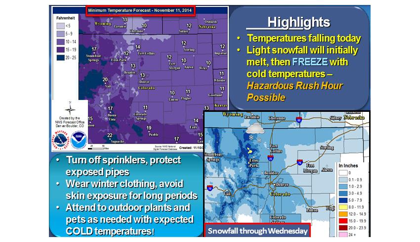
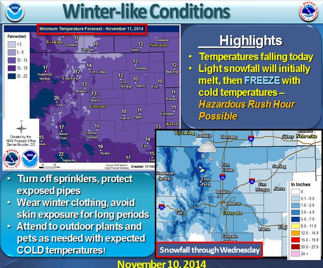
The National Weather Service (NWS) reports that a strong cold front will bring "around an inch or less" of snow to many areas of Northern Colorado, including Denver, by Monday evening.
For most of the state, snow accumulation isn't supposed to be significant, but the foothills and mountains are expected to receive 2-5 inches of snow on Monday, according to the NWS.
But by the end of the afternoon, NWS expects temperatures to be in the teens and single digits with wind chill. Temperatures will stay low for the rest of the week across the plains and foothills, according to Monday morning's alert.
From Tuesday evening until Wednesday night, NWS says light snow is expected over the plains and foothills. Mountain snow is expected to develop by Wednesday afternoon and continue into the the weekend.
Across the state, some people are already reporting temperature drops of 15 degrees or more:
GRAPH: Temp dropped 27º in 30min in Glendale (#Denver) as #ArcticFront pushed through. (Equiv rate of -54º/hr.) #COwx pic.twitter.com/ejLCfHVrr1
#FortCollins has dropped 29°F in 2 hours as temperature has crashed from 62° at 7:50am to 33° at 9:50am. #COwx #weather
Other areas are beginning to see snow:
Getting some snow flakes in Johnstown / Windsor area #COwx
Heavy snow near Red Feather Lakes. Pic courtesy of Red Feather Lakes POA. #cowx pic.twitter.com/rKdrnTqZQe