
Blizzard conditions are forecast to develop Monday night and last into Tuesday afternoon, when the storm is expected to move into western Kansas.
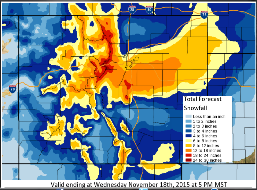
The National Weather Service says between 8 and 18 inches of snow are possible, with the heaviest snow falling south of Interstate 76. The worst conditions are expected to be in the south and eastern parts of the Denver area and on the Eastern Plains.
The snow should be lighter near the Wyoming border but the wind combined with that snowfall is still expected to make travel difficult there.
With snow forecasted to arrive tonight in the Mile High City, Denver Public Works plow crews will be ready to hit the city’s main streets, or most streets with stripes, when snow begins to accumulate. De-icing materials will be utilized, as needed. The public works department has urged motorists to allow plenty of time to get where they need to go, and to be especially careful on bridges and overpasses. More information about Denver’s snow removal process, visit www.denversnowplan.com.
Denver International Airport says its expecting 12-16 inches of snow from the storm, along with strong winds. So far there have been almost 60 canceled flights Monday night and almost 50 Tuesday morning -- most them involving smaller regional carriers. Travelers are urged to check their airlines for updates.