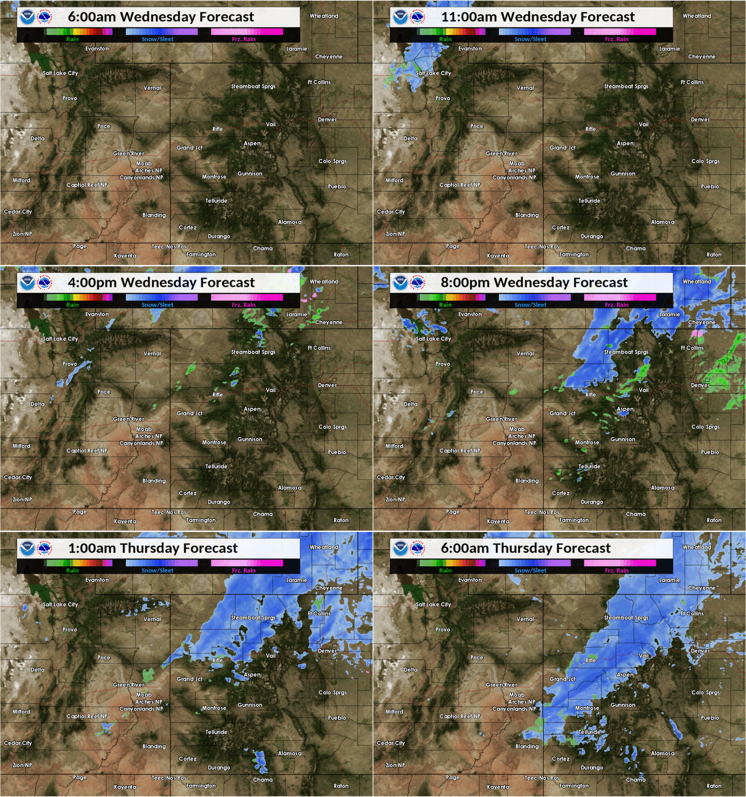
I’m crying because cold weather and (some) snow is expected for the first week of October. We skipped right over autumn, are jumping straight into winter and I’m not ready.
A cold front is expected to bring extremely cold temperatures Wednesday night into Thursday and Friday.
“It might not be so much of a snowstorm,” said Kyle Fredin, a meteorologist with the National Weather Service. “It is going to be a drastic change from very nice fall weather, with above normal temperatures. Everyone’s going to be affected by this just because of the widespread colds… It’s a good solid start to winter.”
Fredin said temperatures will be in the teens. The Front Range could get between 1 and 4 inches of snow. Areas west of Interstate 25 are expected to get closer to 2 and 6 inches with more snow expected in the mountains. And let’s not talk about Wyoming.
You will need to act fast. Fredin advises winterizing sprinkler systems, swamp coolers, vehicles and said trees will be shaken by the cold.
“If they get even just a little bit of snow, I think we could see some damage,” he said. “Thursday night and into early Friday could be in the teens. That'll have a tendency to turn them brown right away. So maybe not a whole lot of color after this.”
If you’re keeping the score at home, that’s no points for the leaf peepers and some points on the board for the powderhounds. Snowmaking was already underway and ski resorts are in eager anticipation of the snow.
For the most part, the snow is right on schedule Fredin said. The Front Range and Eastern Plains usually get snow in the second or third week of October. Denver typically sees snow by Oct. 18.
Denver Rescue Mission and Springs Rescue Mission both expect to have more people in shelters than normal because of the cold.
“Our teams are gearing up right now,” said Travis Williams with Springs Rescue. “They are ready and are expecting that we won’t be full, that we’ll have plenty of space at the shelters.”


