The weather this weekend can only be described as strange but not surprising for Colorado.
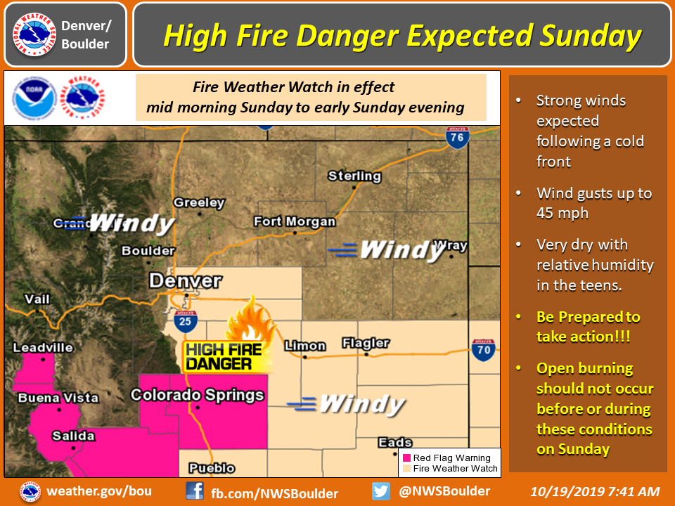
There’s snow forecast for the mountains and high fire danger along the Front Range and in the plains, plus air quality advisories.
“There is nothing abnormal about this,” said Natalie Sullivan, a meteorologist with the National Weather Service.
Four to 10 inches of snow is expected in the northcentral mountains Saturday evening through Sunday morning, Sullivan said. Wind gusts will blow snow around, making it difficult to see while driving.
The lower elevations like the Front Range won’t get much snow if any at all, Sullivan said.
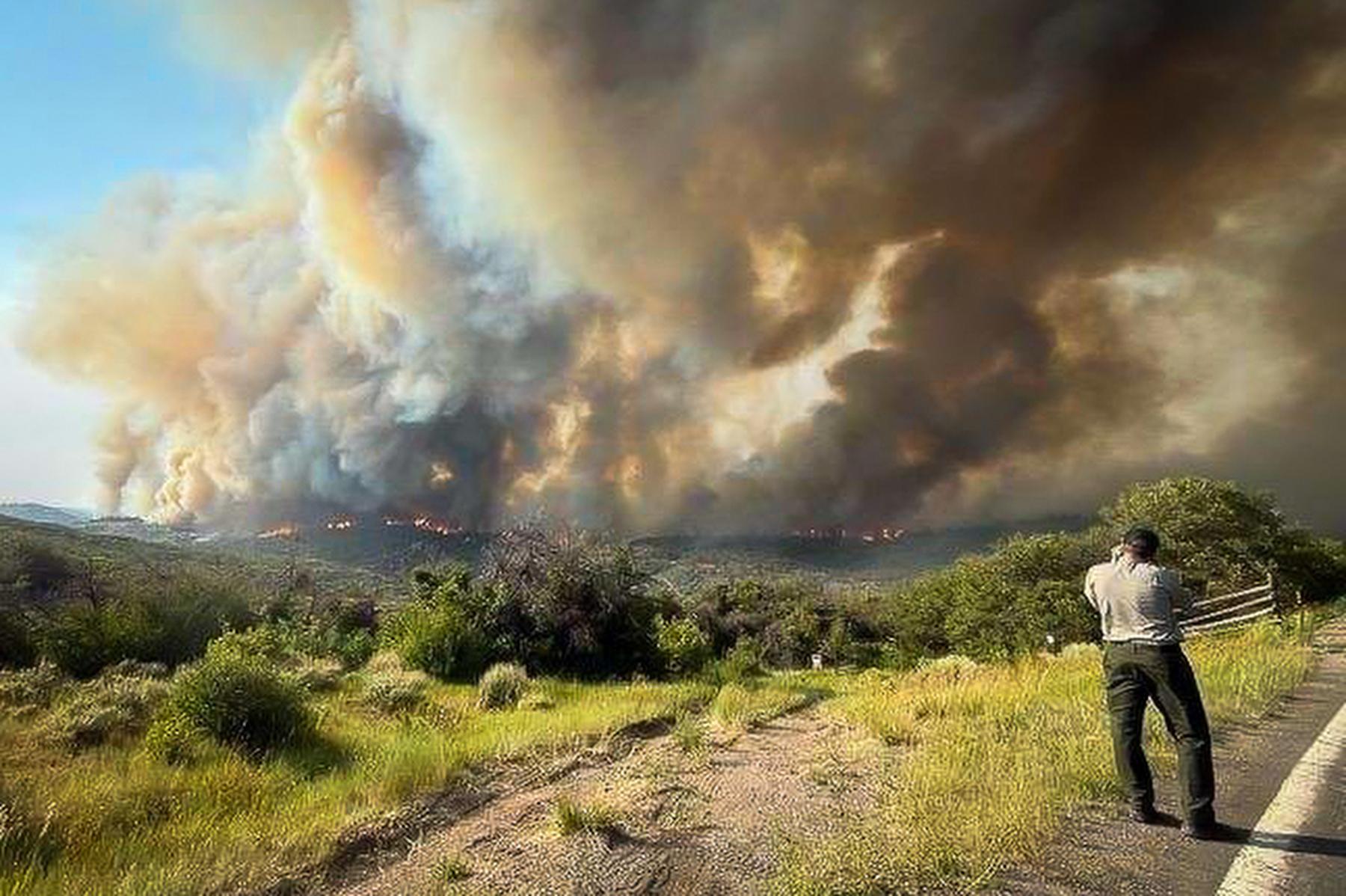
But those same windy conditions and dry fuels are what’s making fire danger so high for central and eastern Colorado. Much of the Front Range was under a Red Flag Warning on Saturday and Fire Weather Watch on Sunday.
“We are advising people to be cautious and not to produce any sparks or flames that could create fires because the winds are going to be strong enough that fires are expected to spread quickly,” Sullivan said.
Fire crews working on the Decker Fire said they are dealing with difficult conditions Saturday. The Elk Fire in Larimer County is 100 percent contained and firefighters will continue to monitor the fire over the weekend.
Western Archuleta County is under an Air Quality Advisory for wildfire smoke. People along State Highway 160 east of Yellowjacket Pass and to the town of Piedra are advised to stay indoors, especially if they have health problems.
Temperatures are expected to be in the 50s for the Denver metro by Monday.