
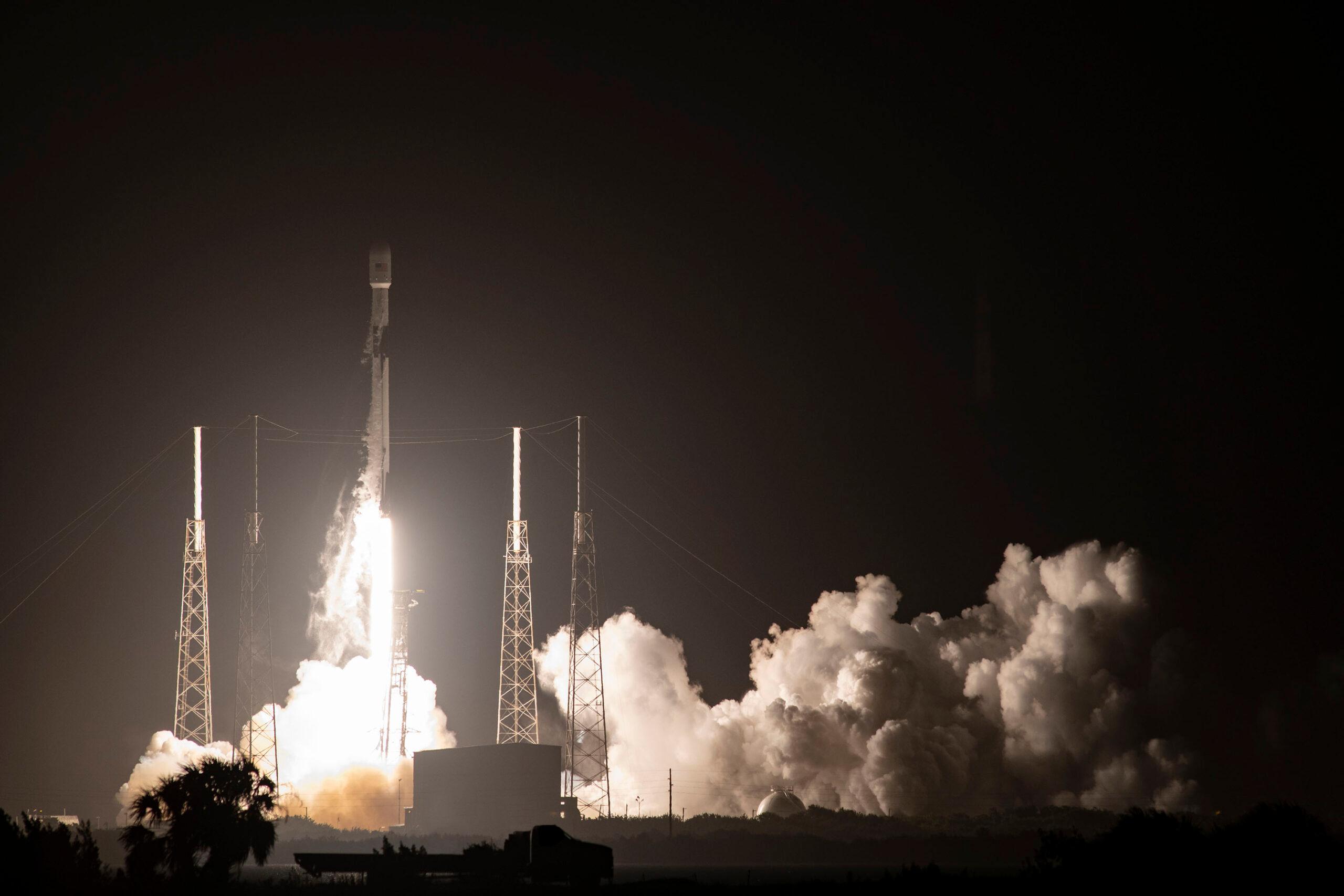
This past November, a fourth satellite in the updated U.S. Global Positioning System, lifted off from Cape Canaveral, Fla. It, like the previous three satellites in the new system, was built by Lockheed Martin in Denver. Like all previous GPS satellites, it is now controlled from Schriever Air Force Base in Colorado Springs, and piloted by U.S. Space Force “Guardians.”
Over the next few years, the U.S. government and its partners will launch up to 32 of these new “GPS III” satellites, eventually providing far more accurate location data for the service’s worldwide civilian user base who rely on GPS for everything from turn-by-turn smartphone navigation to ATM transactions. The more precise data will be key in operating future nationwide efforts such as driverless car networks.
The satellites also include sophisticated new cybersecurity technologies for use by the U.S. military.
“Our enemies have understood since watching Desert Storm and Operation Enduring Freedom and Operation Iraqi Freedom how reliant we have become on GPS. So, they are looking for ways to take it from us,” said Major Gen. Deanna Burt, a former Space Force operations and communications director who now serves as a commander at Vandenberg Air Force Base in California.
Burt said the new satellites, which will gradually replace most of the old GPS, will have eight times the anti-jamming capabilities of the previous system. She said disabling navigation technologies will continue to be an important weapon in future military conflicts. However, despite the advanced defensive technologies of the new GPS III, Burt insists the system does not have offensive capabilities.
Meanwhile, on the other side of the world
Back in June, China launched the final satellite in its GPS competitor, BeiDou. The Chinese system currently has about the same number of satellites as GPS and is touted by Chinese state-run media as providing “more stable and reliable services, as well as an alternative to the U.S.-owned Global Positioning System (GPS) for global users.”
Eric Frazier co-wrote a book on the history of the GPS with the son of one of its inventors. He said China’s BeiDou has been decades in the making and is part of a logical effort by other world powers to reduce such a critical dependency on the United States.
Russia was the first country to launch its own navigation system following the United States. GLONASS was declared operational in 1993, three years after the full initial activation of GPS. In the last decade, Europe, India and Japan have also put up either complete or partial so-called “constellations.”
“That reason was basically a fear that the U.S. in a sudden policy shift could deny access and stop allowing people to use it freely,” Frazier said.
For the most part, due to international agreements, consumers often use multiple constellations to get the most accurate signal.
Though, there are some fears that formalizing and maintaining a relationship with China’s BeiDou system could come with its own complications. The Chinese constellation is unique in being the only one that offers a two-way communication service to users — similar to text messaging. The other systems, like GPS, offer only one-way communication--simply providing satellite location data to earth-bound receivers.
The Chinese Communist Party has “touted on Chinese television, the ability to not only know where you are, but to share where you are with other people. So, a lot of observers are saying that this opens up a cybersecurity issue,” Frazier said, “if the actual device is sending its location information back to the satellite system.”
It’s not yet clear to what degree China could track foreign users of the BeiDou system, another security concern for people in the U.S., as well as for the United States government itself.
Colorado At The Forefront
Foreign relations experts predict the BeiDou navigation system will be another example of a Chinese technology threatening to silo parts of the world — similar to Western fears about implementing Chinese 5G cellular infrastructure.
However, GPS is still the world’s most used navigation system, and Colorado is behind the wheel.
Schriever’s command of GPS for decades, as well as other critical long-term military space installations nearby, has led to Colorado having the nation’s second-largest aerospace economy, with nearly 500 aerospace companies. Lockheed Martin opened a $128 million manufacturing facility in Denver to construct the GPS III satellites in 2011. The first satellite launched in 2018 and the company is under contract to build the full expected GPS III fleet at its Colorado location.
The next GPS III satellite launch is expected sometime in the second half of 2021.