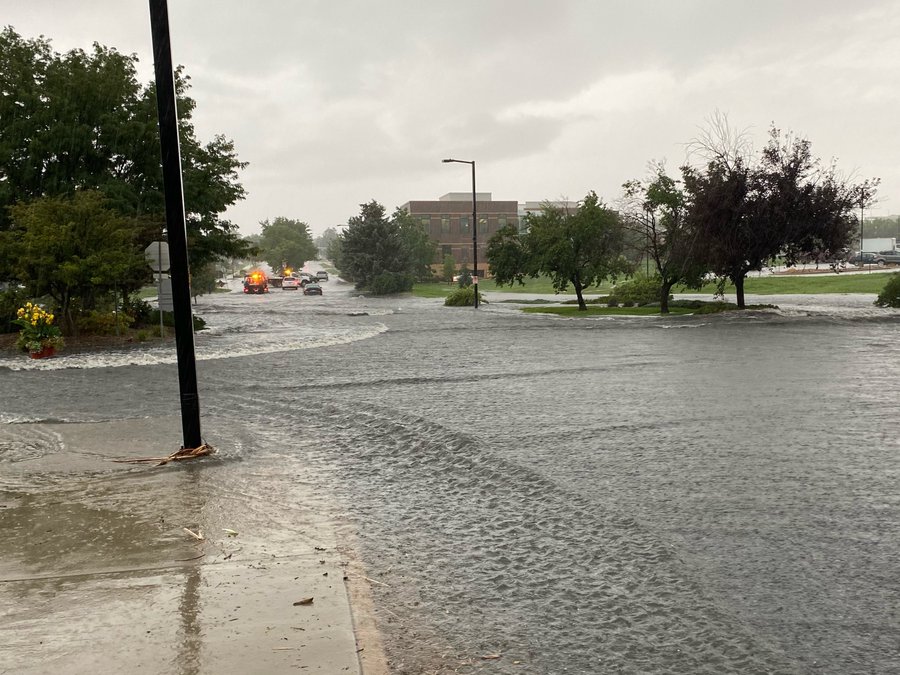
Rain storms are soaking the Denver metro area for the second day in a row, causing flash flooding and temporary road closures.
In Broomfield, the National Weather Service recorded more than 3.5 inches of rain in less than two hours at one of its monitors. The rain has already had an impact, with a flash flood shutting down a community park and closing Spader Way from 1st Ave to DesCombes Drive for several hours.
Local authorities have reported no injuries so far. A flash flood warning for Broomfield lifted at 11 a.m. and no evacuations have been ordered.
Weather forecasters warn storms will move through the south-central metro area this afternoon and evening, which could lead to more flash flooding in communities around Denver.
The NWS recorded up to 3 inches of rain for parts of Centennial, Parker and Aurora Monday, and expects another several inches to fall Tuesday afternoon. The agency has issued a flood advisory for the south metro area through the rest of the day, said Bruno Rodriguez, a NWS forecaster.
“Everywhere from Denver southward is most at risk,” Rodriguez said. “Flooded roads are a possibility and we encourage folks not to drive through the water.”
A flood watch is now in place through midnight for areas between Leadville and Springfield in Southeast Colorado. Showers are forecast for much of the Western Slope later tonight, but the risk of flooding remains low.
The rest of the week is looking drier for most of the state, Rodriguez said. Communities east of the mountains should be dry with highs in the lower 80s. Parts of the Western Slope could see rain Tuesday night, but there are no significant flood risks in the forecast.
This is a developing story and will be updated.