
The surface area of Colorado is 104,094 square miles, according to the US Geological Survey, making it the 8th largest state in the country.
But the state, unlike our neighbors to the east, has a lot of extra geographical stuff — like mountains.
One Coloradan who loves to spend time in those big hills wondered if our dear state wasn’t getting a bit short-changed. Denver-based photographer and editor Howard Paul also happens to love baked goods. So when he posed his question to Colorado Wonders, he couldn’t help but combine his two passions.
“How large would Colorado be if I used a giant rolling pin and rolled it flat, to 1 inch thick?” Paul asked.
One inch thick, making Colorado like a “giant fudge brownie,” he said.
Yum.
The ultimate answer had us both flabbergasted.
Paul had a hunch that such a squishing would make Colorado the largest state in the lower 48. Bigger than Texas. Smaller than Alaska. (For whatever it’s worth, this numerically-challenged reporter thought that was an eminently reasonable guess.)
The first bit of due diligence was to research if this quandary had been approached before. Well, what do you know, the headline of a March 2005 article from Ski Magazine reads “How big would Colorado be if you steamrolled all of the mountains?”
The uncredited author spoke with researchers at the US Geological Survey Denver office, with the result being: “When steamrolled, the Rockies, San Juans, Sangre de Cristos, and all the other Colorado ranges would increase the state’s footprint by about 2,500 square miles — a chunk of land that’s larger than Delaware, and just a teensy bit bigger than Brunei.”
That’s not as dramatic as Paul expected. But it’s also not exactly what Paul asked. The question was not ‘How big would Colorado be if pulled flat?’ More on that distinction in a moment.
When in doubt, ask the scientists
A lot has changed as far as the capabilities of the US Geological Survey in the nearly two decades since the Ski Magazine article.
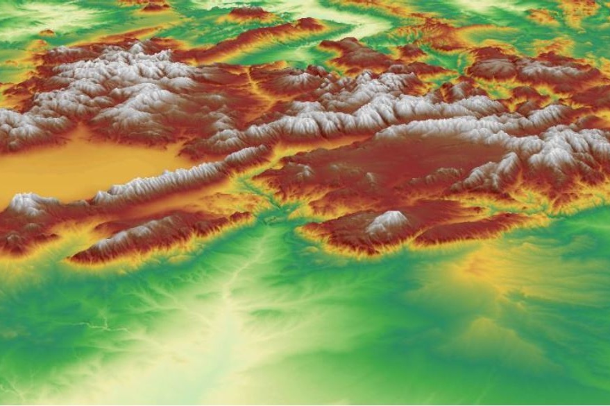
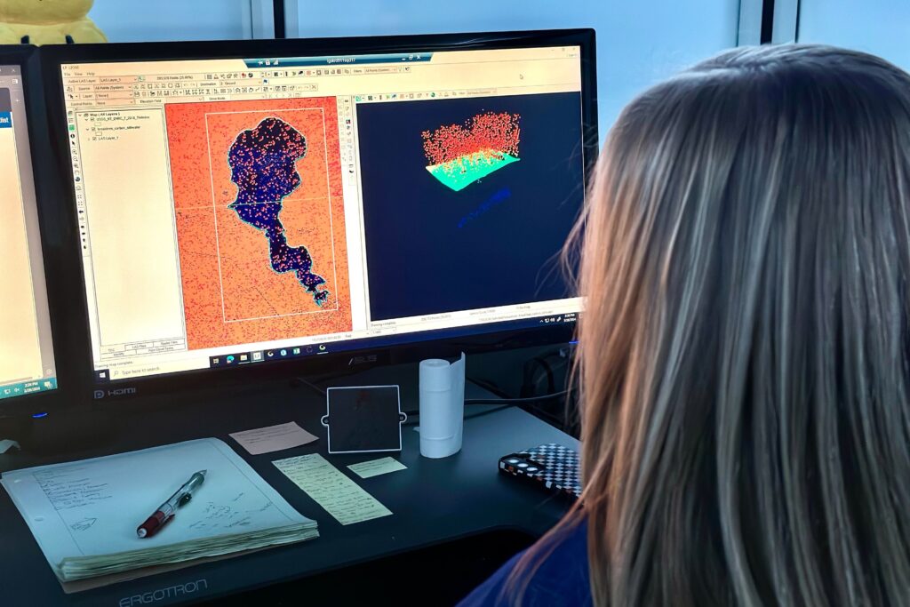
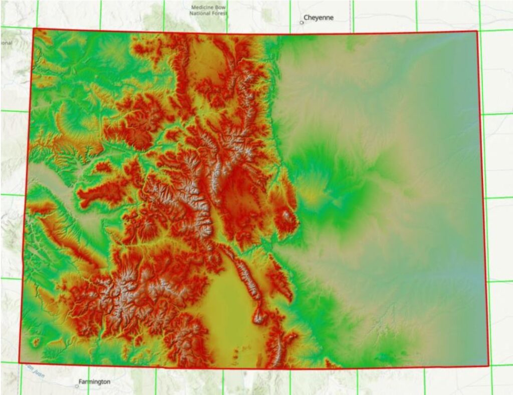
In 2016, the agency began a highly accurate aircraft-mounted LIDAR scan of the entire country. (LIDAR stands for light detection and ranging — sort of like RADAR, but with lasers.) As of today, the project has scanned about 95 percent of the United States. This enormous data set, combined with modern computational prowess, allows for a sincere tackling of Paul’s question.
Kim Mantey, director of the USGS National Geospatial Technical Operations Center, said the problem led to “enthusiastic discussion.”
“Going back to our middle school, high school math classes,” she said. “Thinking about what’s the proper formula to use?”
First, Mantey’s team had to answer some questions and set some parameters — like good scientists are wont to do.
Do we go by simple surface area or include volume?
The team considered taking the surface area of the state and stretching it out as if the uppermost layer were a scrunched-up blanket that you were flattening. (This is basically what they did for the Ski Magazine article, even more on that later.) But Paul’s question mentioned a rolling pin and a 1” thick fudge brownie. The researchers became as caught up in fanciful thoughts of bread dough and cake batter as Paul. So they decided on a true volumetric analysis, counting every bit of dirt and rock underneath the surface. The team would squish the entire state’s volume.
But down to what elevation do you squish the state?
The team discussed going to the center of the earth or going down to sea level. They settled on the state’s lowest elevation. As a previous Colorado Wonders adventure has taught us, Colorado’s lowest point is 3,315 feet above sea level, located in a normally dry flood plain of the Arikaree River.
(Let’s pause for a moment and consider something else: The Earth’s surface is far more horizontal than vertical. So much so that astrophysicist Neil deGrasse Tyson has tried to explain the planet is actually smooth, contrary to what our elementary school globes might have us believe. He says that the height of Earth’s tallest mountains on your typical school globe would be about the depth of your fingerprint.)
When we smash Colorado with our rolling pin, what is included? Land? Trees? Buildings?
They settled on just land.
The Results, drum roll please
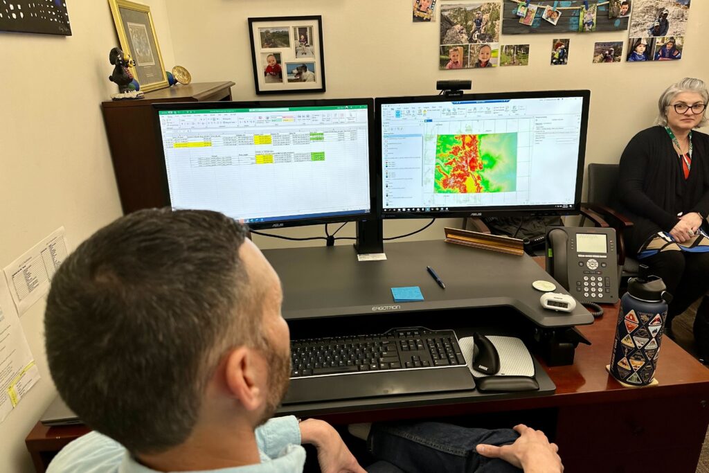
The task of actually crunching the numbers fell to USGS researcher Barry Miller. And, despite all of the immense processing power needed for the exercise, he was able to craft the formula and derive the answer through the use of a pedestrian tool we all know and love to hate: an unassuming Excel spreadsheet.
To put the final answer into proper context, let’s bring in some reference standards:
- Colorado surface area (pre-squish): 104,094 square miles
- Texas surface area: 268,596 square miles
- Alaska surface area: 665,384 square miles
- Total U.S. surface area: 3,796,742 square miles
- Russia's surface area: 6,601,665 square miles
The new post-squish surface area of Colorado, rolling out all of the earth from the tippy top of Mount Elbert, down through the foothills and the plains, everything down to one inch above the state’s lowest elevation, Miller came up with this result.
- Colorado surface area (post-squish): 4,419,041,096 square miles
That’s almost 4.5 billion square miles. To look at it another way: rolling out Colorado to one inch thick leaves us with a surface area that is 22 times larger than the surface area of the planet Earth.
Howard Paul was right about one thing: Colorado would indeed be bigger than Texas.
“Astounding is an understatement,” Paul said. “It’s hard to even picture that.”
Miller was also able to guess the 2005 methodology used for the Ski Magazine article and recreated their results to explain the massive discrepancy. Again, his predecessors used the scrunched-up blanket tactic, according to him. They took just the surface layer of ground and spread it out, and they did that only for Colorado’s mountain ranges, leaving out the plains.
It’s all in the details.
Does this 4.5 billion square mile figure give Colorado extra bragging rights? That’s up to you. However, let’s remember we have been comparing a squished Colorado to non-squished geographical reference points in this thought experiment. How would squished Colorado fare against a squished Texas? That remains unanswered, for now.
“I would be interested to see what it would look like comparatively for all 50 states,” Mantey said.
Until then, Paul’s reflection on the rolled-out Colorado size was poignant and on brand.
“That is one big friggin brownie,” he said.
It absolutely is.
Editor’s note: Should you desire to run the exercise yourself, the data is all publicly available. Click this link for a detailed report on the USGS methodology.