Firefighting crews have made progress containing several fires on the Western Slope, helped by some cloud cover and a dip in temperatures.
An air-quality alert remains in effect until Saturday at 9 a.m. for Mesa and Montrose counties due to lingering wildfire smoke, according to Colorado’s health department.
A huge portion of the Western Slope may also see thunderstorms and gusty winds today, and flash flooding could occur in burn scars and slot canyons, according to the National Weather Service’s Grand Junction office.
South Rim fire
The South Rim Fire burning in Black Canyon of the Gunnison National Park is now 14 percent contained, and crews are expected to make more progress on holding the fire, according to Tyler Nathe, an operations section chief with the Rocky Mountain Area Complex Incident Management Team 3, which is managing the fire.
In a video update, Nathe said several firebreaks dug by bulldozers are holding, but that trees, grasses and other fuels in the canyon are still “very receptive” to igniting.
The fire destroyed or badly damaged multiple buildings in the park, including the South Rim campground, the facility management building, bathrooms and overlooks throughout the park, according to the National Park Service.
All reservations at the South Rim campground as well as wilderness permits are cancelled, with no reopening date set, the service said.
The fire is now 4,251 acres, or roughly 6.6 square miles. That number may change — a plane using infrared cameras to map the fire did not fly last night.
Turner Gulch fire
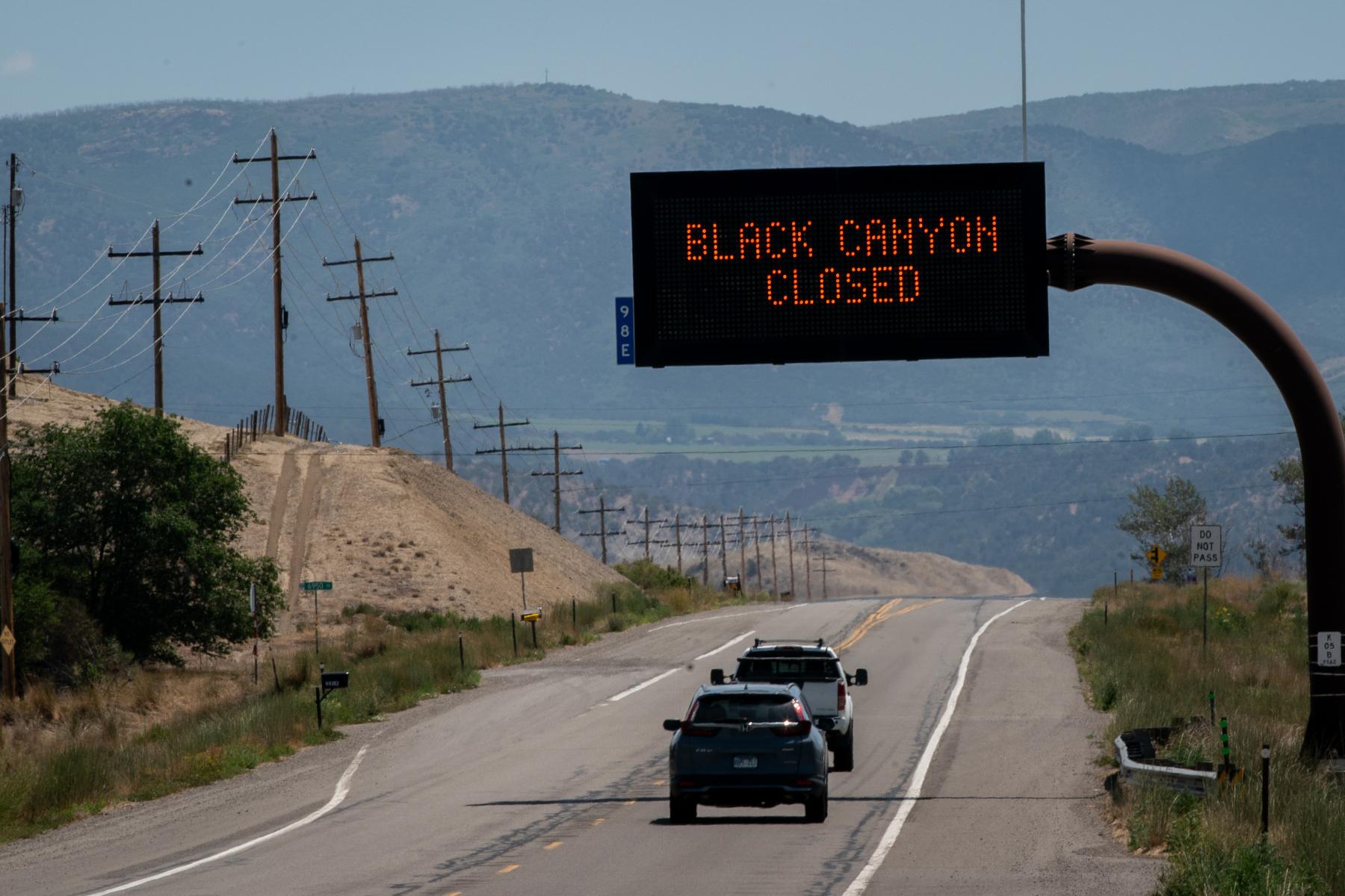
The Turner Gulch and Wright Draw fires are still burning on opposite sides of the Unaweep Canyon, south of Grand Junction. The Turner Gulch fire is now at 15,286 acres — bigger than the isle of Manhattan — and is 34 percent contained.
It remains the largest fire burning entirely within Colorado.
Rob Powell, a section chief with a Rocky Mountain Incident Team that’s managing the fire, said in a Friday video update that his team was hoping to return some evacuees back into their homes “sometime today,” in consultation with the Mesa County sheriff’s office and the state department of transportation.
On Friday, the Mesa County sheriff’s office downgraded all private lands between mile markers 120 and 134 along Highway 141 to a “pre-evacuation” status and directed residents to an interactive evacuation map.
Crews with bulldozers are still working across steep and remote terrain to contain the fire, with some help from the weather, according to Powell.
“We kind of got a little bit of a break in the weather,” Powell said in the video. “Mother Nature’s always in charge, and she doesn’t have a heart.”
Wright Draw fire
The Wright Draw fire is much smaller, at 448 acres. Powell said that while “things were looking pretty good” in suppressing the fire, it could still spread.
“We don’t trust it and the fuel type,” Powell said. “Something squirrely could happen.”
Cottonwood Flat fire
The Cottonwood Flat fire, a brush fire on a county road between Rulison and Parachute, broke out Thursday and by Friday stood at around 311 acres, according to Watch Duty, a fire-monitoring app.
Residents within a one-mile radius of 1800 County Road 309 are under evacuation, according to the Garfield County Sheriff’s Office.
Sowbelly fire
The Sowbelly Fire in the Dominguez-Escalante National Conservation Area is now around 24% contained and stands at 2,274 acres.
The Bureau of Land Management, which is managing the fire, said the blaze was “creeping and smoldering,” but that they are making progress in securing a perimeter around it.
Deer Creek fire
A small portion of the nearly 16,000-acre Deer Creek Fire is burning in Colorado, near the town of Paradox. Part of the county’s western edge is under a pre-evacuation notice as of 8:30 a.m. Friday.
The entire fire is now 11% contained.