Colorado's natural landscape has withstood forest fires, beetle infestation and rising temperatures over the last century. Satellite images from NASA offer a unique glimpse at how our corner of the planet has changed.
Drag the slider back and forth to see the change, and check out NASA's full "Images of Change" gallery here.
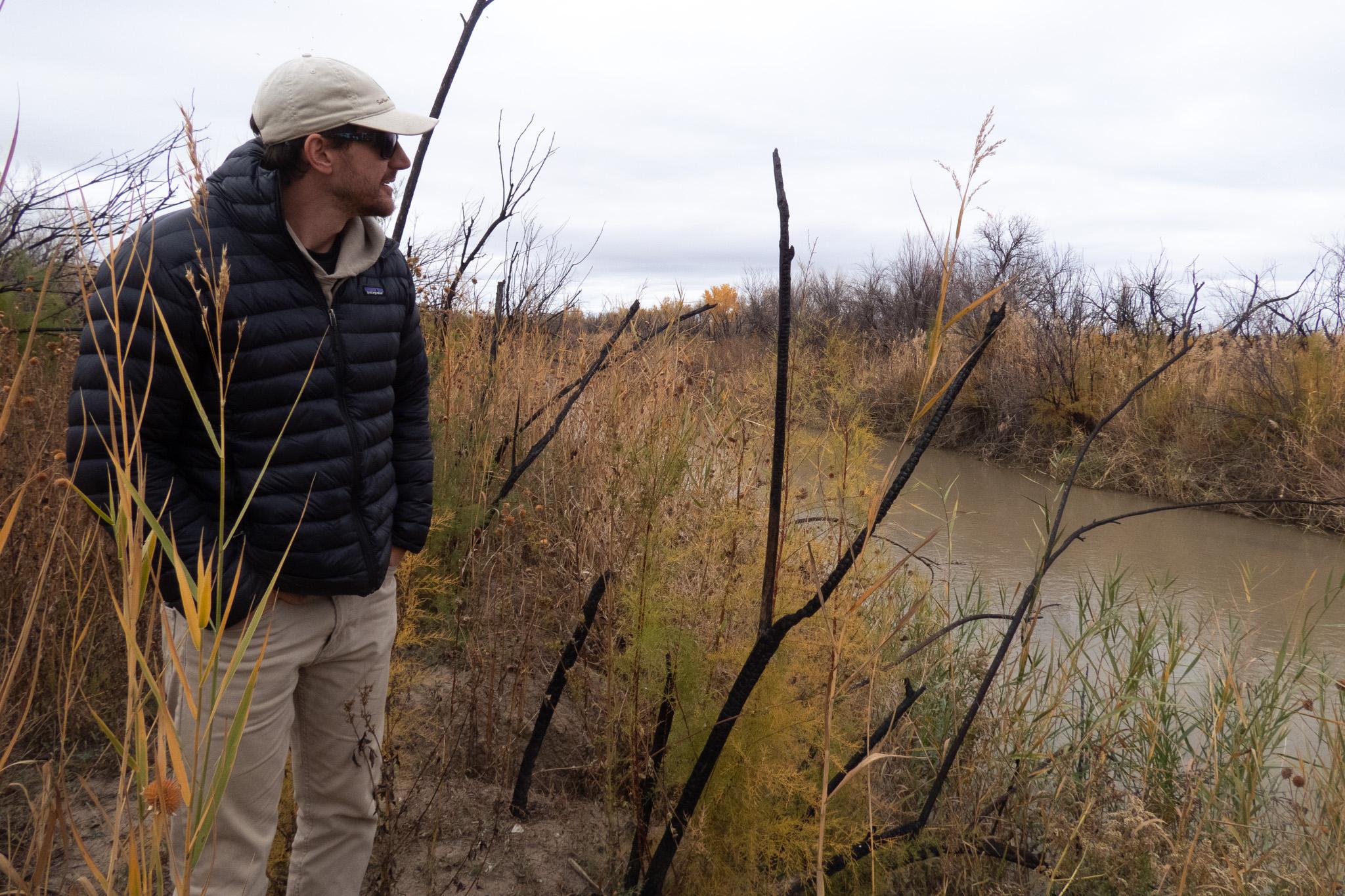
Black Forest Fire
The Black Forest Fire near Colorado Springs, Colorado, was the most destructive wildfire in the state's history, having burned over 14,000 acres and more than 500 homes. It was responsible for the deaths of two people and forced thousands more to leave their homes. The fire started June 11, 2013, and was considered fully contained on June 20, 2013. It began along the north side of Shoup Road, which forms the southern boundary of the burned area seen in the June 22 image. The northern portion of Colorado Springs is visible at the lower left.
- NASA
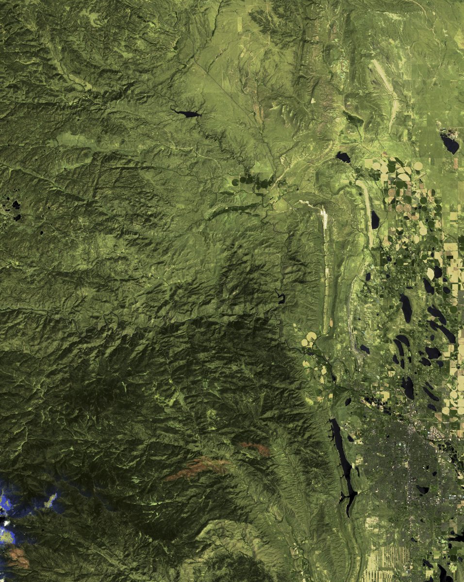
Great Sand Dunes National Park

The Great Sand Dunes National Park and Preserve, home of the tallest sand dunes in North America, is the newest U.S. national park. It is located in the San Luis Valley at the base of the Sangre de Cristo Range in Colorado. The valley’s stream flows change from season to season and year to year, and these images show the difference between 1987 and 2011. Water access is especially critical in the region as center pivot irrigation systems (shown as circular features west of the feeder streams) rely on aquifer recharges. Originally a national monument, the area was given the distinction of national park in September 2004.
- NASA
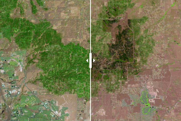
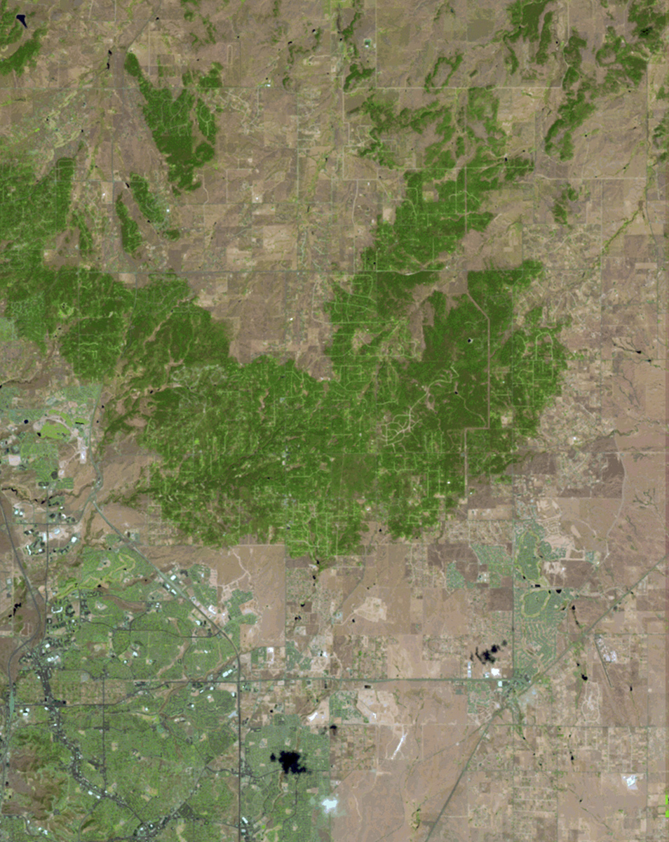
High Park Fire
Sparked by lightning on June 9, 2012, the High Park Fire burned more than 87,000 acres near and in Roosevelt National Forest, just west of Fort Collins, Colorado. One person was killed and at least 259 homes were destroyed. High temperatures and strong winds hampered efforts to extinguish the blaze, which was the second largest in Colorado history.
- NASA
Arapaho Glacier melt

Arapaho Glacier, Colorado. Left: 1898. Right: 2003. Arapaho Glacier has shrunk dramatically since it was photographed in 1898. Measurements collected since 1960 suggest the glacier has thinned by at least 40 meters since then; thinning between 1898 and 1960 is unknown but is probably considerably greater than 40 meters.
- NASA
Tree loss in Rocky Mountain National Park

Rocky Mountain National Park, Colorado. Left: September 22, 2003. Right: September 25, 2010. Mountain Pine Beetles killed about 60 percent of the medium-to-large lodgepole pines on the western slopes of the park between the years depicted here. In the 2003 image, dense vegetation (dark green) is seen near the center. In the 2010 image, the dark green has been replaced by shades of brown over large areas, indicating tree loss.
- NASA
All images courtesy U.S. Department of the Interior / USGS and NASA.