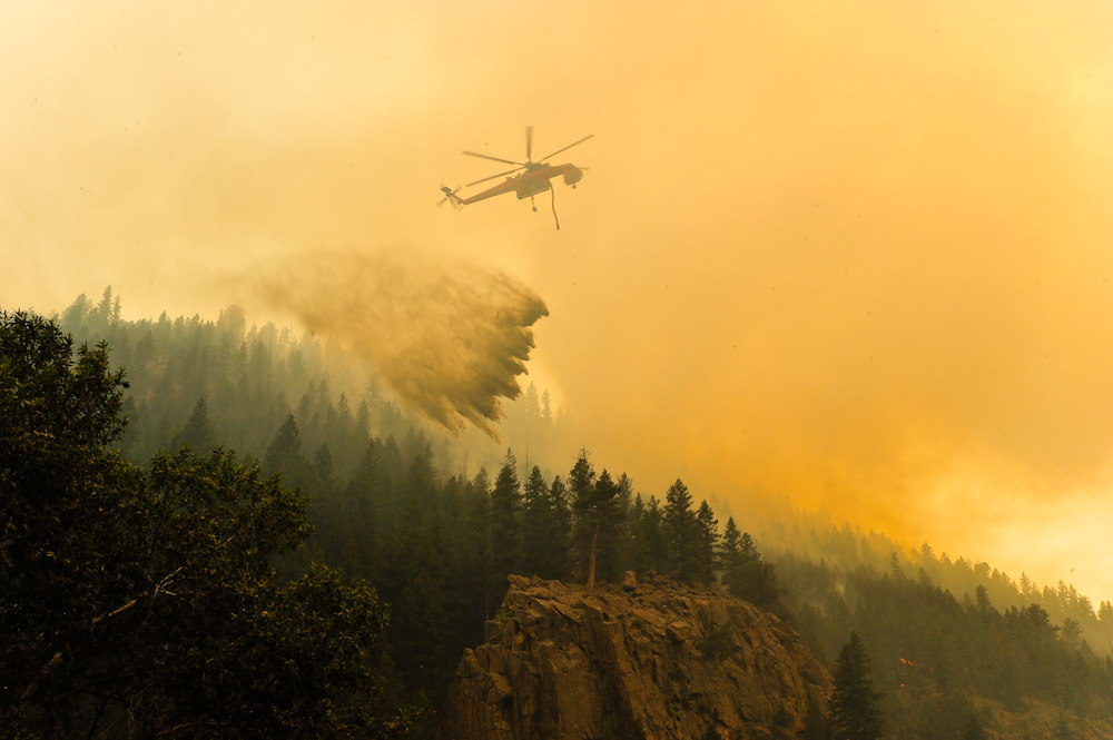
Fire danger is high in southeast Colorado and across the Great Plains owing to a combination of high winds and low humidity.
"We’ve had a couple weeks since our last snow, then of course we’ve got really warm temperatures, dry conditions and it doesn’t take long for those fuels to dry out," says Scott Entrekin of the National Weather Service in Boulder. "The biggest impact is going be today, tonight and through Friday morning. And then things will kind of not be so windy, and cooler for the weekend."
It has been windy today across Colorado. The weather service recorded wind speeds above 90 miles an hour last night near Estes Park and in Summit County.
Meanwhile, Denver broke its 86-year-old heat record today, recording a temperature of 73 degrees.
Denver International Airport has reached 73 degrees so far. This breaks the old record of 71 degrees set in 1930. #cowx
Further south, Pueblo, Colorado Springs and Alamosa all broke heat records as well. And Grand Junction tied its record high of 62 degrees.
More seasonable temperatures will soon return to the Front Range. Meanwhile, Bloomberg reports that 2016 is on track to top last year as the hottest year on record.
To be sure, some of the recent extremes are the result of a monster El Niño weather pattern that still lingers in the Pacific Ocean. But the broader trend is clear: We live in a world that's warming rapidly, with no end in sight.