Updated at 11:45 a.m.
A long stretch of near triple-digit heat has given way to wetter, slightly cooler conditions along most of Colorado’s Front Range. Scattered thunderstorms are in the forecast for Denver, Boulder and Colorado Springs most days through next weekend.
The high in Denver is expected to be close to 90 on Monday, with temperatures in the mid-80’s through the rest of the week, according to the National Weather Service. Colorado Springs and Grand Junction will also see cooler weather than last week for the next five days.
The break in heat has ushered in more moisture than Coloradans have seen so far this summer.
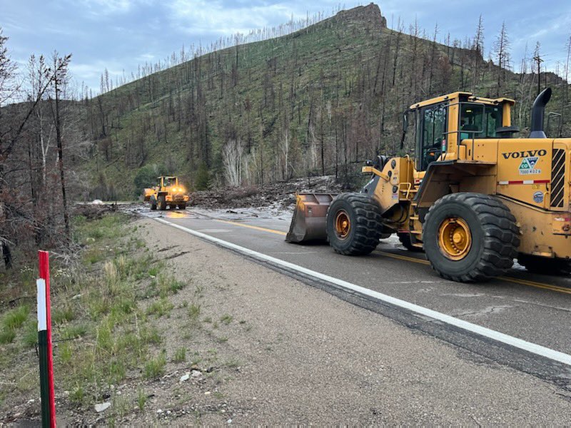
Storms this weekend already triggered flash flood warnings in multiple cities. A mudslide in Grand County shut down a stretch of Highway 125 between Trail Creek and FS Road 112 over the weekend. No injuries were reported.
After a mostly dry Monday in the Denver area, scattered thunderstorms are expected to pop-up in the afternoons and evenings each day through Saturday.
The rain will likely bring some drought relief, but not enough to make up for an unusually dry year, said Evan Direnzo, a forecaster with the National Weather Service. Normally, the Denver area would have logged 1.6 inches of rain so far this month. This year it’s recorded just about half-an-inch.
“Even with a good week, it is almost certain that we're still in catch up by the end of the week,” Direnzo said. “We might get lucky though.”
The moisture will also bring elevated risk of flash flooding in areas near wildfire burn scars. The Cameron Peak, East Troublesome, Cal Wood and Williams Fork scars will all see flood threat rise starting Tuesday.
Thursday has the highest risk currently, with all four areas listed as “elevated” danger, according to the NWS.
Stormy conditions are also forecast for Vail and Grand Junction starting Monday night.
Drier and warmer weather is expected to return sometime next weekend, according to the NWS.