Updated: Sun. February 25, 2024 at 6:17 p.m.
Snow, warm temperatures, strong winds and red flag warnings will be seen across Colorado through Monday afternoon.
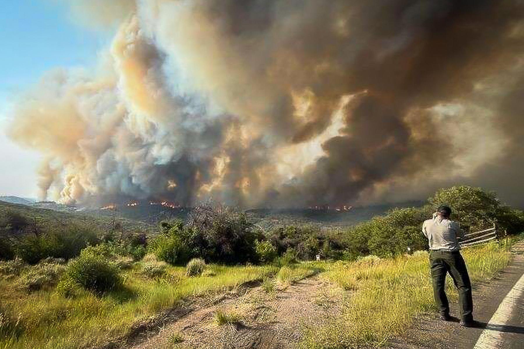
The National Weather Service has issued a red flag warning for nearly the entire Front Range and Eastern Plains. Critical fire conditions will begin around noon Sunday and persist until the sun sets on Monday. Gusts of wind of up to 60 miles per hour could quickly accelerate fires started in affected areas.
The state has seen several minor fires in recent days as temperatures warm up. In Boulder, firefighters attended to a small wildfire that ignited in the flatirons on Saturday. The fire was fully contained by Sunday morning, but firefighters warned that the fire conditions will persist.
The Colorado Springs Fire Department posted on X, the site formerly known as Twitter, on Sunday that an "active fire" was burning on the U.S. Air Force Academy Grounds. The department had requested help from neighboring fire departments, and the academy issued pre-evacuation orders for the Douglas Valley and Pine Valley housing on the grounds, according to Katherine Spessa.
In Aurora, a "large wildland fire" was burning just east of E-470 and north of I-70, though the size and cause are not yet known. Aurora Fire Department had not responded to CPR News's request for comment.
Meanwhile, heavy snow may fall at high elevations when a storm system hits the state Monday night. Accumulation in the most affected areas will range between eight to 30 inches, but will likely let up quickly.
“This is a pretty fast moving system, so we're looking at just about [a] two to five hour duration snowfall on Tuesday,” said NWS meteorologist Bernie Meier.
Travel along I-70 is expected to be difficult to impossible starting Monday night, with blowing snow conditions likely and strong gusts of wind potentially causing extensive tree damage.
The warm weather along the Front Range isn’t expected to last. The snowstorm expected in the mountains could roll to the Front Range Tuesday morning, bringing colder temperatures and a possibility for snow to the I-25 corridor.
“Two to three inches is what we're looking at, and that'll be behind the [Front Range] Tuesday, probably mid to late-morning through the afternoon hours,” Meier said.