Coloradans worry when there is not enough moisture. Coloradans also worry when things are green - fearing they'll turn brown and catch fire. So, is there a “Goldilocks” amount of rain that would be just right to ease that concern?
“I don't know if it's an amount that would be the Goldilocks. I think it's more the timing and the duration,” said Denver chief meteorologist Lisa Hidalgo. “In a perfect world, your Goldilocks would be, we get rain for a couple of days and then sunshine for a few days, rain for a couple of days, sunshine, but that doesn't happen obviously. We get these stretches of very dry hot weather and that's what ends up drying things out.”
The summer solstice was Friday, June 20, and with the start of summer came a record-tying high temperature of 99 degrees in Denver. Colorado will see a return to the 90s by this weekend.
“Pride weekend looks great for the parade Sunday morning (in Denver), it's always obviously cooler in the morning. We'll hit highs, probably close to 90, both Saturday and Sunday, so it's going to be toasty, but very few storms and your typical summer days,” said Hidalgo.
Looking further ahead to the Fourth of July holiday weekend, Hidalgo says right now, it’s shaping up to be in the upper 80s with maybe a few storms.
Here are highlights from Ryan Warner’s monthly weather and climate conversation with Hidaglo. It has been lightly edited for length and clarity.
Ryan Warner: Indeed the summer solstice was a sizzler. We did not hit 100, but I'm curious how often we see triple digits in Colorado.
Lisa Hidalgo: It depends on the year, obviously, but on average, two or three triple digit days every summer. There have been some that have been way hotter. 2012, that’s our record number of triple digit days. We had 13 that year and five of them were consecutive.
Warner: We used to get more of a break when the sun went down, but I understand we are weathering hotter nighttime temperatures in general as well.
Hidalgo: Can I quiz you right now? When do you think we hit our low every day?
Warner: I think we hit our low at 6 a.m.
Hidalgo: Ding, ding, ding, ding. A-plus for you. It's very early. It's right at sunrise when we typically hit the low for the day. A lot of people think it's as soon as it gets dark, right? It's overnight, the middle of the night we hit the low, but it's actually throughout the night as temperatures are gradually dropping, they get to their lowest right before the sun rises and starts to heat things up for the next day. So yes, nighttime temps have been warming, which means it can get pretty uncomfortable some evenings. I mean, this past weekend, we were in the 80s I think between about 11 pm and midnight.
Warner: I'm just going to consult my notes here because there's a new report from Climate Central that finds the average summer nighttime temperature in Denver has increased two and a half degrees between 1970 and 2024. Same story for Grand Junction, 1.3 degrees and Colorado Springs 2.3 degrees. So this is a function of climate change. We pray for overnight relief and we don't necessarily get it.
Hidalgo: You get it a little bit, but in general, if the daytime high is going to continue to rise each and every year, it's going to be pretty clear that the nighttime temp is going to take longer to cool off and you've only got so many hours overnight for it to happen. So these numbers don't surprise me.
Warner: This is also severe weather season, not that heat isn't its own severe type of weather, but I am referring to thunderstorms here. Hail twisters, and there was a rare tornado northwest of Pikes Peak last week that toppled hundreds of trees. What do we know about this storm?
Hidalgo: It was wild. I mean, we had a pretty intense week last week. We had the large hail up across parts of Northern Colorado. This tornado, the National Weather Service will typically go in after there's a report of a tornado just to double check. They'll look at the damage. They'll see how strong it was if it was in fact a tornado. There had been talk that maybe it wasn't, but they went in and I think in this case, they used a drone to see the pattern of the trees that were downed. I think it was over 15 acres of damage to trees, and it ended up being an EF-1 tornado with highest wind gust at about 106 miles per hour.

Warner: I just don't think of twisters in the high country. I think of it as a plains phenomenon.
Hidalgo: And usually yes, we don't see many in the high country, these high altitude tornadoes, but it happens every once in a while, but typically it's cooler, which means it's more stable in the mountains, and so that's why we don't usually see it.
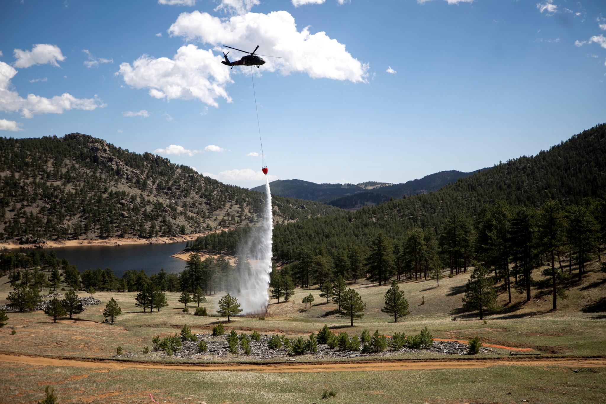
Warner: This is supposed to be a typical wildfire season now that still means thousands of fires across the state. What are you monitoring headed into our warmest months?
Hidago: I get nervous that everything's so beautiful and green right now because all it takes is a stretch, a period of dry hot days for that to dry out and then become tinder, and then obviously we see things spread a lot faster. I wish that that wasn't the case, but everything is. I mean, it's so beautiful right now. We're just kind of hoping that we keep that precipitation going off and on throughout the summer.

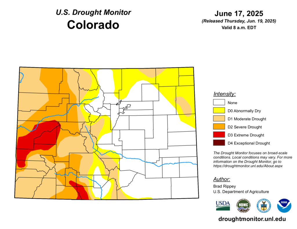
Warner: How do the snowpack and runoff look? I was in the mountains this past weekend. I was in Creede, Colorado on the Rio Grande, put my toes in the water. It was quite lovely. What do we know about our biggest reservoir right now?
Hidalgo: Snowpack is almost nothing now. I looked at some of the recent numbers, well below 10 percent, but that's very typical as we get into the end of June and early July. There’s lots of snow melt out there, so things look good. Drought conditions don't look so great right now on the Western slope. It has really dried out over the past couple of weeks, and we get new drought monitors every Thursday, so it is not looking so great over the Western slope.
Warner: Artificial intelligence is coming into play for meteorologists. Google is working with the National Hurricane Center on a new AI model to forecast storms.
Hidalgo: I think they're using it to help us with the forecast. The spaghetti model of a hurricane is the one where it's all the little colorful noodles when you're looking at the path of a hurricane. That's called the spaghetti model. So it gives you many different potential paths for a hurricane. I think in this case, what this is going to do is help. I think any tools that we can put towards keeping people safe and saving lives at the end of the day is good.
Warner: Having some assistance crunching the data. Having lived on the Gulf Coast of Florida for some time, I'm used to that spaghetti model and sometimes it would show your house right in the path or it might turn off and hit a different community altogether. So if AI would mean more precision, I'm not against that.
Hidalgo: I think that is exactly what this is, but I do think, unfortunately, they're also looking at using this because of the cuts with the National Weather Service. You've got fewer bodies that are putting their minds into getting these forecasts out, and so I think this is because of that. They're having to find another way to use computers to help.