
From day to day, we give little thought to how Colorado's cities, counties and mountains get their names. Colorado Springs author Jim Flynn investigates in his new book "A Compendium of Curious Colorado Place Names."
Here are some examples from the book:
Colorado
"Colorado is the Spanish word for “ruddy,” referring to a reddish brown color. Early Spanish explorers gave this name to the Colorado River (Rio Colorado), which in some places carries a great deal of silt and has this color. The name was then given to the Territory of Colorado when it was formed in 1861 out of parts of the Territories of Kansas, Nebraska, New Mexico and Utah. The name carried over to the state of Colorado when it was established in 1876, earning it the right to call itself the Centennial State. The land that is now Colorado was assembled by the United States through the Louisiana Purchase (1803); a war with Mexico, which resulted in Mexico ceding land to the U.S. (1848); the annexation of the Republic of Texas (1845); and a deal cut with the state of Texas in 1850. (Some Colorado residents are of the opinion that, based on the occasional questionable behavior of tourists from Texas, this annexation should never have been allowed to occur and the Republic of Texas should have remained a separate country.)"
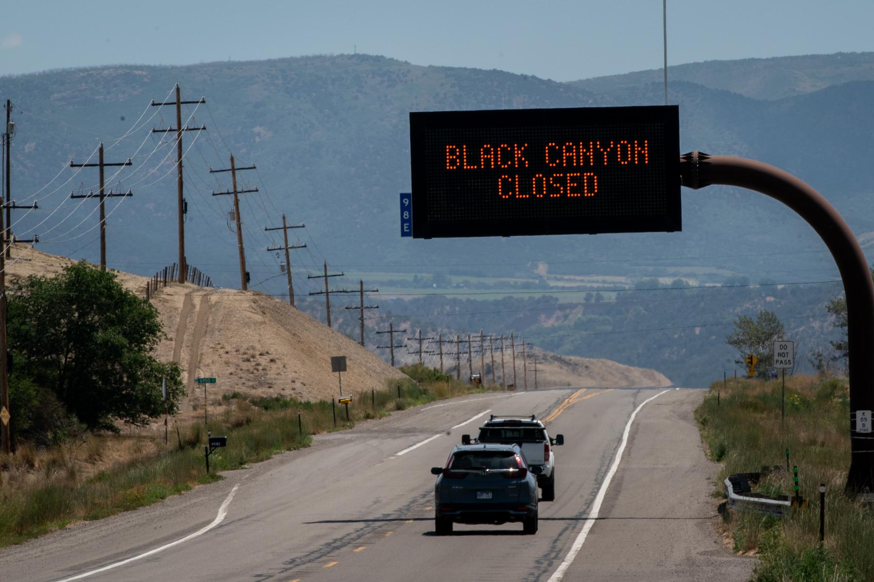
Dotsero
"Although it’s been suggested by some that this name, given to a small town in Eagle County along the I-70 corridor, comes from a word in the Ute language meaning “something unique,” the better theory is that the name came from a start-of-the-line marking on an old Denver & Rio Grande Western Railroad map --“.0” -- that is, “dot-zero.” In any event, the town sits at the base of Colorado’s most recently active volcano, the Dotsero Crater, which last erupted some 4100 years ago and is showing no signs of a repeat performance."
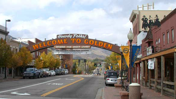
Golden
"This name doesn’t -- at least not directly -- come from the metal. It comes from Thomas L. Golden, who hailed from Georgia and was one of the first prospectors to show up in Jefferson County when the Pikes Peak gold rush began. The city of Golden, founded as a mining camp in 1859, was named after him. Golden sits along Clear Creek, is home to the Colorado School of Mines, the National Earthquake Center and, most importantly, the Coors Brewing Company. Famous western showman William F. “Buffalo Bill” Cody is buried on nearby Lookout Mountain. Golden was the capital of the Territory of Colorado from 1862-1867. The capital, for better or for worse, was then moved east twelve miles to Denver."
- Related: Joseph Collier Made A Name Photographing Colorado. 100+ Years Later, His Descendant Repeats The Feat
Huerfano
"Huerfano (pronounced WEAR-fan-oh) means “orphan” in Spanish. The name was given to a dark mound of volcanic rock — Huerfano Butte -- that sits all by itself in an otherwise mostly flat area just to the east of Interstate 25 and north a few miles from Walsenburg, in south central Colorado. The name was then given to one of Colorado’s original seventeen counties, created at the time Colorado became a territory in 1861. When first formed, Huerfano County took up most of the southeast corner of the Colorado Territory. Then, however, it went through several geographic shufflings, giving up land to Las Animas County and Pueblo County, and a county called Greenwood that only lasted four years before it became Bent County and Elbert County. In yet another shuffling, Huerfano County finally got land back from Fremont County."
Montrose
"Demonstrating that at least some of the people giving names to Colorado places more than a century ago were well read, the name Montrose comes from a novel by Sir Walter Scott published in 1819, 'A Legend of Montrose.' This novel mostly dealt with a steamy love triangle wherein two male suitors were in testosterone-enhanced pursuit of a woman named Annot Lyle. But, the background noise for the story had to do with a civil war in Scotland in the 1640’s wherein the Earl of Montrose played a prominent role. The city of Montrose was chartered in 1882 and Montrose County, in west central Colorado, was created shortly thereafter, in 1883."
Quandary
"Quandary Peak, at 14,265 feet, is Colorado’s thirteenth tallest mountain. It was named by a group of miners who, in the early 1860’s, came upon a mineral deposit on its slopes they could not identify. Thus, they were in a quandary over this mineral and that led to the naming of the mountain. It’s not known if they ever did figure out what the mystery mineral was, or what they were drinking when they came up with this name. Quandary Peak is in central Colorado and is a part of what is known as the Ten Mile Range. It lies some seven miles to the south of Breckenridge and presents a spectacular vista when traveling south on Colorado Highway 9 from Breckenridge toward Hoosier Pass."
Sneffels
"Here we have something of a mystery. Mount Sneffels, in the San Juan Range in southwestern Colorado, at 14,150 feet, holds position number twenty-seven on the list of Colorado’s highest mountains. However, there are at least three theories as to where this name came from. One theory ties the name to a volcano in Iceland -- Snaefell -- featured in Jules Verne’s 1864 novel A Journey to the Center of the Earth. In the novel, Mount Snaefell rose above the great hole in the surface of Earth by which the center of the Earth was to be reached. A second theory, much less dramatic, ties the name to someone named Sneffels who was associated with the U.S. Government Hayden Survey, four members of which (none named Sneffels) made the first recorded ascent of the peak in 1874. The third theory is that the name derived from “sniffles” because the miners in the area in the 1870’s kept catching colds, and weren’t much good at spelling."
Yampa
"This name comes from an Indian word for a plant (a member of the parsley family) that is still present, and once was abundant, in northwest Colorado. It was an important food source for Indian tribes living in the area. The roots, when cooked, apparently have a crunchy texture and are mildly sweet, resembling water chestnuts. (Beware, however, that when eaten raw and in excess, they become a laxative, something the Indians also figured out.) The Yampa River is one of Colorado’s major rivers, with its headwaters just east of the small town of Yampa, in Routt County. The river then flows westerly through Steamboat Springs and continues on to a confluence with the Green River (a tributary of the Colorado River) at Dinosaur National Monument, near the Utah border. The river’s total length is some 250 miles."
(Reprinted with permission from The History Press/Copyright 2016 by Jim Flynn)