
Posted: July 9 | Updated: July 12
Editor's Note: With decreasing fire activity across the state, this story will not be updated after July 12. Our original story continues below.
--
Here are the latest updates on wildfire happenings around the state, including some arrests:
Smith Fire
Location: 5.5 miles north of Meeker
Size: 76 acres
Containment: 80 Percent
The Smith Fire was reported the evening of July 9 and was started by lightning. Crews worked to set up fire lines.
Skunk Creek Fire
Location: 30 miles north of Craig,
Size: 620 acres
Containment: 100 Percent
The Skunk Creek Fire was reported July 8 burning in oak brush near the Wyoming border. The cause of the fire is lightning. Firefighters have been successful keeping the fire contained and not moving toward structures in Wilderness Ranch and Bakers Peak.
Red Canyon 2 Fire
Location: 2.5 miles east of Wolcott, Colorado
Size: 26 acres
Containment: 100 Percent
The Red Canyon 2 Fire started July 8 and was burning less than half a mile away from the Red Canyon Estates on White River National Forest lands. The cause has not be determined but lightning was reported at the time. Evacuations for the Red Canyon Estates subdivision have been lifted and residents are able to return home. No new fire growth has been reported at this time. Firefighters continue with mop-ups to strengthening fire lines.
Chateau Fire
Location: 7 miles northwest of Cripple Creek
Size: 1,423 acres
Containment: 100 percent
The Chateau Fire destroyed at least eight homes and numerous outbuildings. All pre-evacuations were lifted Monday morning. Three Colorado Springs residents, including one juvenile, were charged with first-degree arson in starting the fire, the Teller County Sheriff’s Office reported Monday morning. Each of them faces 4-8 years in prison and a $3,000 to $750,000 fine if convicted. It is believed they left a campfire unattended, the Sheriff’s Office said.
Lake Christine Fire
Location: 1 mile northwest of Basalt
Size: 6,345 acres
Containment: 49 percent
All mandatory evacuations were lifted July 11.
Fire crews continued with mop-ups and hot spot control Monday on the west and south ends of the fire. They also improved fire lines along the southeastern and northwestern perimeters. The Lake Christine Fire began July 3 and spread rapidly on July 4, destroying three homes. Word spread by social media led to an impromptu rally for firefighters by grateful residents on July 10, the Aspen Times reports.
The Eagle County Sheriff’s Office said two suspects fired tracer rounds at a shooting range, igniting the flames.
Spring Creek Fire
Location: 5 miles northeast of Fort Garland
Size: 107,967 acres
Containment: 83 percent
After being forced out to weeks ago, the first group of evacuees returned to their homes Thursday morning. Crews continued to fight fire lines and protect structures. Emergency personnel worked on restoring power to the area Thursday.
The southern perimeter of the Spring Creek Fire is now fully contained. Crews continue to focus on mop-up. There is minimal activity in the southern end of the fire.
The fire started June 27 and is the third-largest wildfire in Colorado history. Fire crews worked to improve fire lines near Road 572 and south of Red Wing on Sunday. They also monitored Tres Valles, Navajo Ranch.
The Costilla County Sheriff’s Office said Jesper Joergensen, 52, started the fire. He was arrested July 3. Joergensen gave officials conflicting accounts about how he started the fire on his property.
416 Fire
Location: 13 miles north of Durango
Size: 54,129 acres
Containment: 50 percent
Closure areas were reduced and the Colorado Trail was reopened Thursday. The fire continues not to be a threat.
Most firefighting resources have been released because of daily rain over the 416 Fire. The fire is no longer considered a threat. A national firefighting team brought in to battle the fire is leaving, giving responsibility for monitoring it to San Juan National Forest officials.
Firefighters say it will take a lot of rain or snow to completely extinguish it and it could still produce smoke before that happens.
The fire started June 1 and the cause is unknown.
Burro Fire
Location: 14 miles south of Rico
Size: 4,593 acres
Containment: 50 percent
Closure areas were reduced Thursday and the Colorado Trail was reopened. The fire continues not to be a threat.
Rain on Sunday afternoon reduced the Burro Fire's activity and smoke, but embers continue to smolder. Fire restrictions remain in effect in the San Juan National Forest, and in Montezuma and Dolores counties. The Colorado Trail is still closed from Molas Pass south to Junction Creek. The Hermosa Creek Wilderness is also closed. The Burro Fire started June 8 and is under investigation.
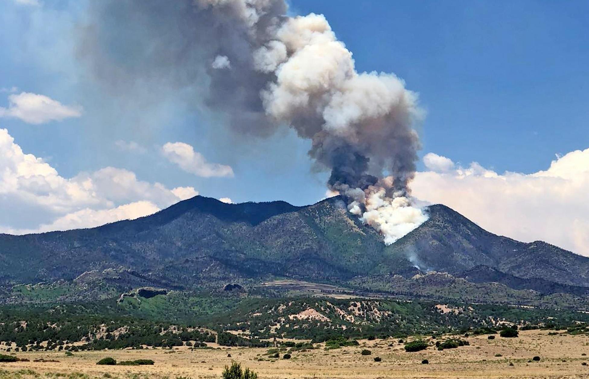
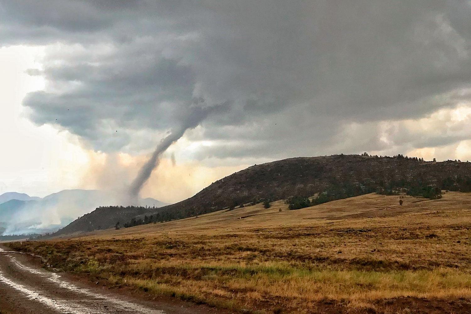
Sugarloaf Fire
Location: Arapaho National Forest south of Byers Peak Wilderness
Size: 1,280 acres
Containment: 20 percent
The Sugarloaf Fire was started by lightning June 28. Rugged terrain and numerous dead trees left behind from the Mountain Pine Beetle “bug kill” 20 years ago make the area dangerous for firefighters. Unexpected tree fall and lightning is possible. The fire is not threatening any homes or businesses, Inciweb reported Thursday morning.
- More: Visualize Just How Bone-Dry Colorado Is With This Drought Map
- More: As Colorado Dries Out, We Need A New Word For Drought
Fawn Fire
Location: 30 miles southwest of Meeker
Size: 1,400 acres
Containment: 90 percent
The Fawn Fire was reported July 7, burning a rugged and remote area of Piceance Basin. No structures were threatened. The cause was determined to be lightning.
Weston Pass Fire
Location: 9 miles southwest of Fairplay
Size: 13,023 acres
Containment: 74 percent
Fire crews continued monitoring fire lines and worked to hold the perimeter of the fire along Highway 285, Thursday morning.
The Weston Pass Fire was started by lightning and has been burning since June 28. On July 10, the Park County Sheriff lifted the evacuation for the Campground of the Rockies. Conditions are still favorable for fire crews, but aircraft have been grounded during storms due to winds.
Divide Fire
Location: Great Divide area, 23 miles north of Craig
Size: 19,955 acres
Containment: 100 percent
The Divide fire has been fully contained, Inciweb reported Tuesday morning. The fire began June 29 and the cause remains under investigation.
- More: Lawmakers: Please Stop Flying Their Drones Over Wildfires, Please
- More: Sen. Gardner Calls Wildfire Drone Flyers 'Morons'
Chedsey Fire
Location: Routt National Forest, southwest of Walden near Teal Lake
Size: 45 acres
Containment: 75 percent
The Chedsey Fire began burning June 30. The cause is under investigation, and there has been one minor injury reported. Crews will patrol the fire perimeter to monitor for hotspots, no increase in fire activity has been reported.
Thornburg Fire
Location: 5 miles west of Maybell
Size: 1,636 acres
Containment: 100 percent
The Thornburg Fire was 100 percent contained Sunday night. The fire started July 6, and the cause remains in under investigation.
Buffalo Fire
Location: 2 miles west of Silverthorne
Size: 81 acres
Containment: 100 percent
The Buffalo Fire began June 20. The fire area was closed for hot spots and the potential for falling trees. The cause is unknown.
The Associated Press contributed to this report.