The Colorado River has shaped life as we know it in the southwestern United States. Its water has allowed for explosive population growth and agricultural development in some of the driest parts of the country. But due to overallocation and climate change, the river is drying up.
What that means for the future of life in the southwestern U.S. depends, in large part, on how the seven states that rely on the river renegotiate the 1922 Colorado River Compact, and whether they finally allow tribal nations a seat at the bargaining table. In April, the federal government released options for how the states and tribes could cut their use of the river. The states and tribes have until May 30th to comment on the options before federal officials announce a decision.
Over the past year, CPR news worked on “Parched,” a podcast about the Colorado River and some of the brightest and boldest ideas to save it. We looked at the history of the river, the 1922 compact, and how the rover has allowed millions of people to live in the West.
How long is the Colorado River and where does it start?
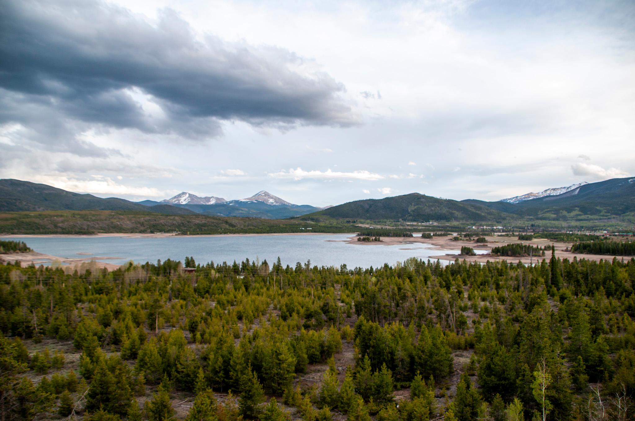
The river is 1,450 miles long and originates near Grand Lake, Colorado, in Rocky Mountain National Park. It starts as snowfall, then melts and travels southwest through Colorado past Moab, Utah, and then continues on through Lake Powell, on the border of Utah and Arizona. In Arizona, the river continues west and reaches Lake Mead on the Nevada border, before turning south towards California and Mexico. Along the way it blends with other rivers, and collects precipitation.
What is an acre-foot of water?
Simply put, it’s the amount of water that covers one acre of land, one foot deep. It’s about enough for two to three households for a year.
How many people depend on the Colorado River?
The Colorado River system supplies tens of millions of people across the West with water to drink, shower, and work, and it irrigates around 5 million acres of farmland. In addition to that, tens of millions of people visit this region annually, and tourism has become an increasingly large economic driver for the region.
Some proposed housing developments, particularly in Arizona and southern Utah, are being held up because of water shortages. It’s a strong indication that in the near future, the drought will dictate where people can live, how much homes are worth, and where companies and their employees can locate.
Is the Colorado River drying up?
In short, yes. The 1922 compact apportions 15 million acre feet of water a year, divided up among the states. In the current drought, which started in 2000, far less water than that is coming down the river – only about 12 million acre feet a year. It’s been even less in the past three years. That’s why collectively, we’re draining our savings in Lake Mead and Lake Powell, as well as in smaller reservoirs.
Over time, climate change means scientists expect the river will keep delivering less water. How much less is the subject of debate, but it’s predicted to be in the range of 10-45 percent less water by 2050.
What is the Colorado River Compact?
In 1922, seven western U.S. states signed an agreement about how they would use the water in the Colorado River. The states in the upper river basin – Colorado, Wyoming, Utah and New Mexico – agreed to keep a certain amount of water in the river to ensure the flow reaches states in the lower basin – Arizona, California and Nevada.
That agreement was amended in the 1940s to ensure river water also reached Mexico.
Crucially, the states excluded the voices of tribal nations that live in the upper and lower river basins when they wrote the agreement.
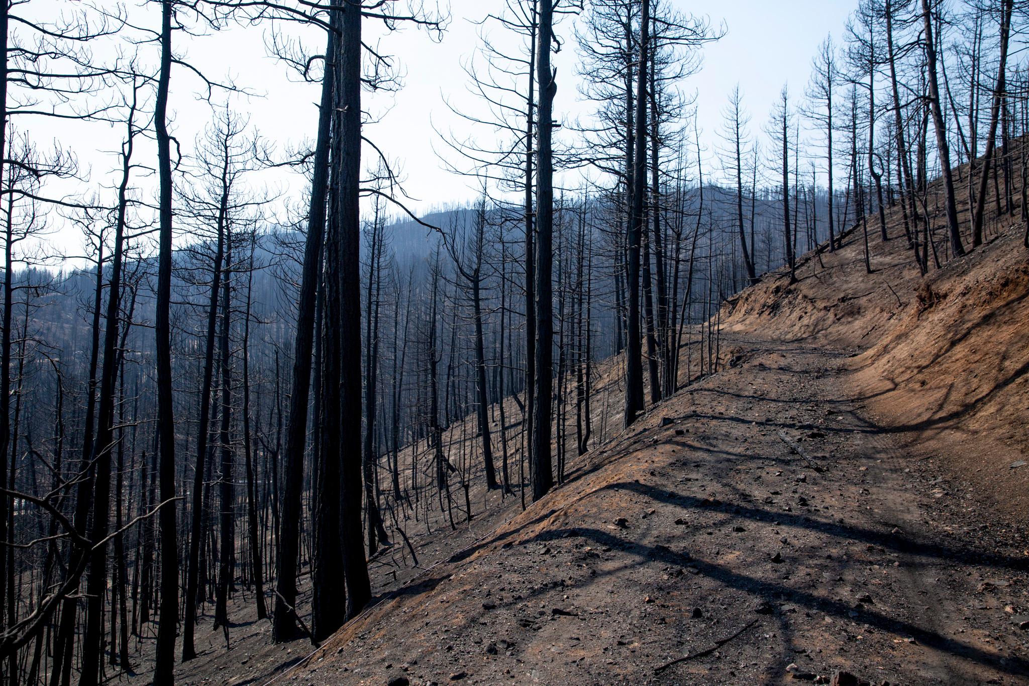
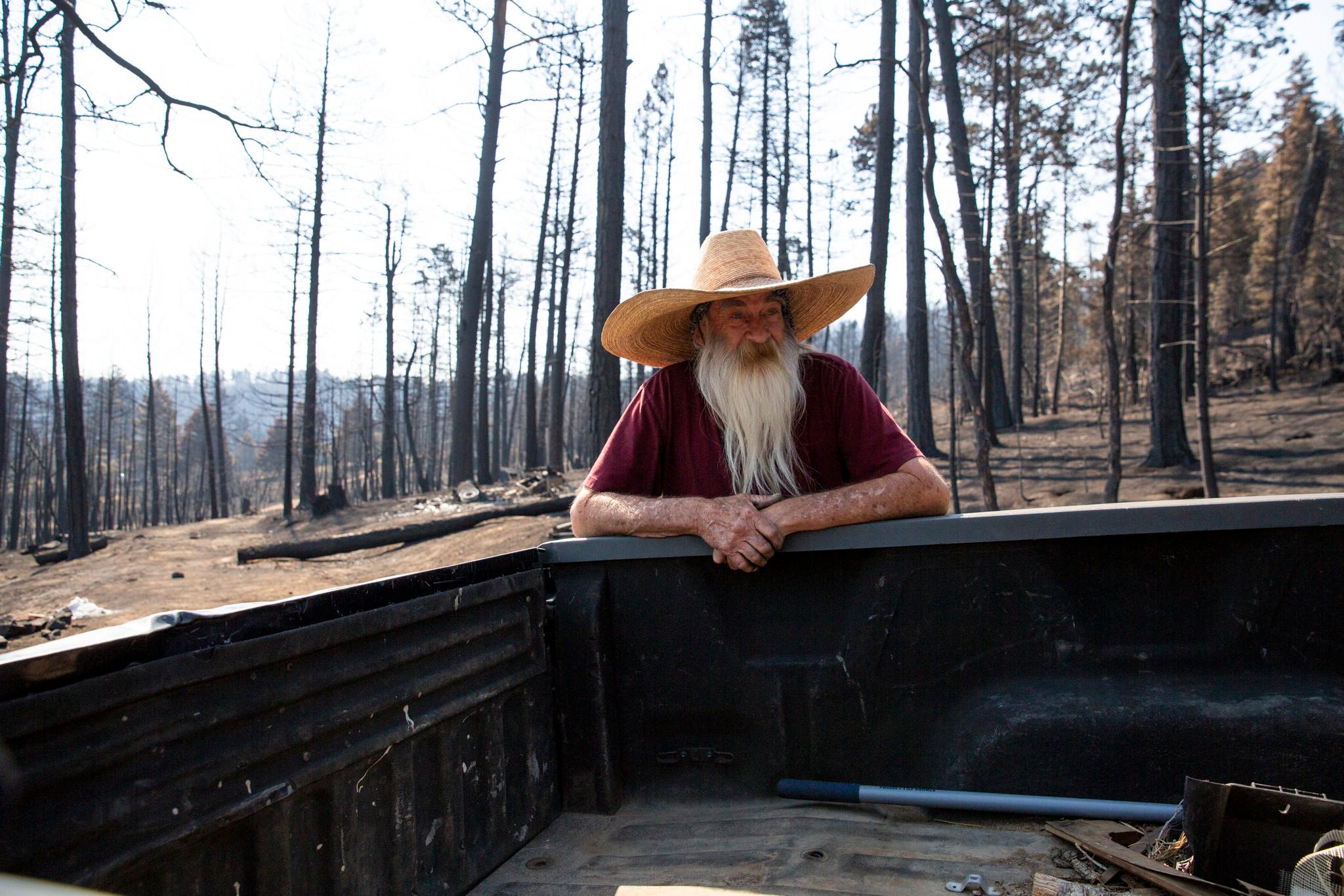
While populations in the West have boomed, we are using more water than is currently available, in part because the region is in a megadrought that has severely reduced how much snowmelt and rain is available in the river for our use.
As the 100-year anniversary of the compact approached in 2022, the seven states, as well as tribal leaders, worked to negotiate a new agreement on who gets to use the water that’s available. However, they missed several deadlines imposed by the U.S. Bureau of Reclamation to decide on cuts that would conserve water. The current rules that divvy up the river expire in 2026, so that’s the deadline for them to come to a new agreement.
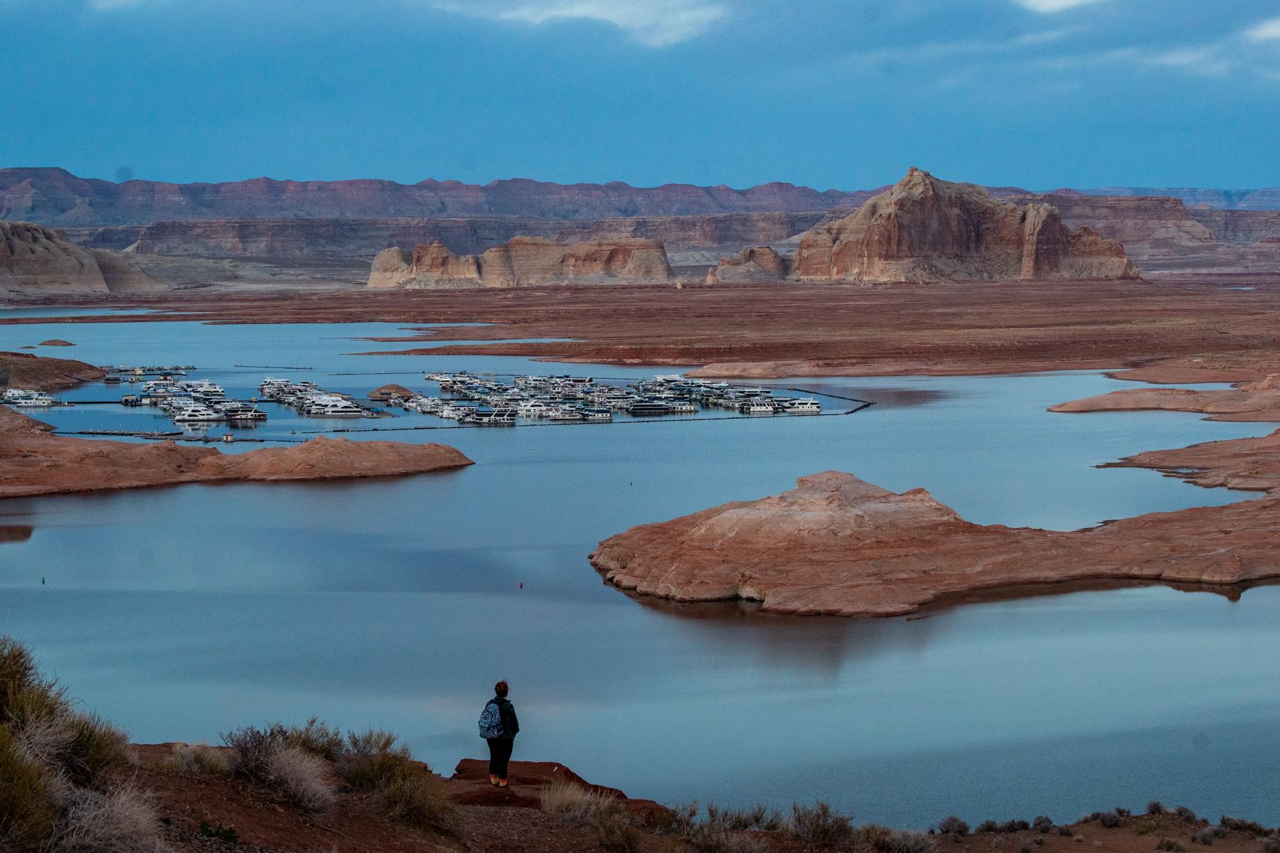
What are the water levels in Lake Powell and Lake Mead?
Lake Mead sits at 1,046 feet – near its lowest point since the 1930s, and about a quarter of its capacity.
When CPR News staff reported there in October 2022, we could see parts of the lake that had disappeared as the reservoir filled up, that no one thought they would see again. Hoover Dam, which creates Lake Mead by stopping up the Colorado River, has spillways for when the water level gets too high for the dam. The spillways haven’t been used since the 1980s.
Lake Powell is at 3,524.9 feet at the time of publication – also a near-historic low. But both are expected to rise this year because of strong snowpack this past winter.
The big, pressing fear in the current drought is that both Lake Powell and Lake Mead will get too low to keep delivering water to downstream states (Arizona, California and Nevada) and Indigenous tribes, as well as Mexico – and that the dams that create these reservoirs will stop producing power, which supplies more than 1.3 million people.
Before water gets below those critical levels – known as deadpool – the federal government and the states will take steps to bolster the lakes’ levels. But it’s a delicate dance to see how far the reservoirs need to drop before states will be willing to take drastic steps to reduce water use, or create more water supplies from other sources like desalination.
Why doesn’t Colorado keep more Colorado River water in this state, instead of sending it downstream to other southwestern states and tribal communities?
Collectively, Colorado and the other upper basin states (Wyoming, New Mexico, Utah) are legally allowed to use 7.5 million acre feet of Colorado River water. But they don’t use that full share, so the upper basin states do have a legal argument to build more reservoirs to store and use more water.
But climate change has messed with that equation. There isn’t enough in the river for all the states and tribes to get all the water they are legally entitled to. And Nevada, Arizona and California also have the right to use 7.5 million acre feet.
If Colorado and the other upper basin states were to start using or storing more water, that would mean less for the downstream states. That would challenge an agreement made in 1922 that said the upper basin states wouldn’t deplete the river, to allow a set amount of water to flow downstream to meet the needs of Arizona, Nevada, California and Mexico.
Nevertheless, as recently as this year, some political leaders in Colorado have proposed building more reservoirs to store more water here, instead of letting it flow out of state. But doing so would likely result in lawsuits, and would present permitting and community challenges that could delay it for decades. For example, for the past 20 years, the utility Northern Water has been trying to build a reservoir and pipeline in northern Colorado, and it is not yet cleared to happen.
Some people have set up greywater reuse as an at-home solution. Is this something Colorado would require?
In Colorado, most cities don’t allow greywater reuse.
Greywater is lightly contaminated wastewater, which can come from our showers, bathtubs or laundry machines. It can be reused for outdoor watering if a homeowner separates it from other wastewater, like from toilets or kitchen sinks, and if it’s cleaned it can be used to flush toilets.
Because of concerns about health and safety, at-home greywater reuse was illegal in most of the region until the 1990s, when states started changing their rules to make it possible. But states largely still leave it up to cities to decide how permissive they want to be.
Starting in 2015, Colorado health and environment regulators made it legal for cities to allow at-home greywater reuse, but only a few have created rules to allow it.
Legal restrictions haven’t stopped some people from rigging up systems at home, though. And in some cities that don’t allow at-home greywater reuse, the local water utility has invested in reusing wastewater for outdoor irrigation at a much bigger scale. Cities can use treated wastewater for watering golf courses and city parks, for example. The Denver Zoo uses it for large animal habitats, among other things.
More on the Colorado River
- Why we made ‘Parched,’ a podcast about the Colorado River crisis
- How drought is changing the Colorado River and the lives of the people who depend on it
- US floats options to reduce water pulled from Colorado River
- If the Colorado River keeps drying up, a century-old agreement to share the water could be threatened. No one is sure what happens next.