This weekend, expect typically atypical spring weather across the state.
Starting Friday, much of Colorado will face high winds and a red flag warning. Snow is likely in the high country with rain on the Front Range and Eastern Plains on Saturday. And then Sunday may bring more high winds to lower elevations and snow to the high country. Then, conditions will slowly revert to mild and spring-like throughout next week.
“It's a wild spring weather pattern that we have coming across Colorado,” said David Barjenbruch of the National Weather Service in Boulder.
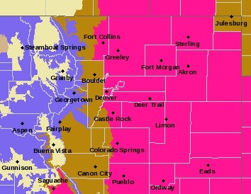
Friday, temperatures will hover in the 30s and 40s for much of the state. Meteorologists warn of high fire danger. The red flag warning spans from the foothills to the state’s eastern border, plus a pocket of fire danger near Saguache in the southwest.
“We're going to see very strong winds and very low humidities. That all spells potential for some rapid fire spread,” said Barjenbruch. “We're asking everybody today to be very cautious.”
Caution means no open burning and avoiding activities that can produce a spark, such as: lawn mowing, dragging chains and shooting firearms in areas with dry vegetation.
“We don't want to start that next wildfire out here in Colorado,” Barjenbruch cautioned.
Starting Friday night, snow is likely in the mountains and throughout the Interstate 70 corridor.
“We think there's going to be a period of some very heavy snowfall as we head into the late night hours and then early morning Saturday,” said Barjenbruch. “Be mindful of that if you're heading up to ski and trying to catch some of that fresh snow.”
Temperatures in the mountains will be in the upper 20s and low 30s on Saturday. The Front Range and the Western Slope will experience slightly higher temperatures in the 40s and 50s. Thunderstorms or showers may spread into the Plains starting early Saturday morning.
By Saturday afternoon, much of the Front Range and Eastern Plains will experience “a period of very, very strong winds,” cautioned Barjenbruch. “We think we're going to see widespread gusts, probably greater than 60 miles per hour across almost all of the Plains. We're talking potential for 70 to 80-mile-per-hour gusts along the I-25 corridor from Fort Collins down through the Longmont and Denver area. And then once we get next to the foothills, closer to Boulder, there is potential that we see 100-mile-per-hour wind gusts.”
Barjenbruch added that it's possible for some places to experience power outages due to the wind.
“It is a very active storm system,” said Barjenbruch. “Be careful out there.”
A red flag warning may still be in effect on Sunday if precipitation is minimal across the Front Range and the Plains on Saturday.
Temperatures along the Front Range will return to the upper 50s Sunday. Temperatures in the mountains will be in the mid-30s to low-40s.
By the end of the weekend, the mountains may see up to 19 inches of fresh snow near Steamboat in Routt County. Places like Arapahoe Basin, Keystone, Breckenridge and Copper Mountain in Summit County could see up to 9 inches with Vail and Beaver Creek in Eagle County receiving about a foot.
After the weekend storm, “it looks like there's going to be some better weather as we head into toward the latter half of the week and next weekend as well,” said Barjenbruch.