8:15 PM
El Paso County has released a map detailing changes in evacuation areas and the burn zone. Click here. Please note, it's a zoomable .pdf and may take some time to load.
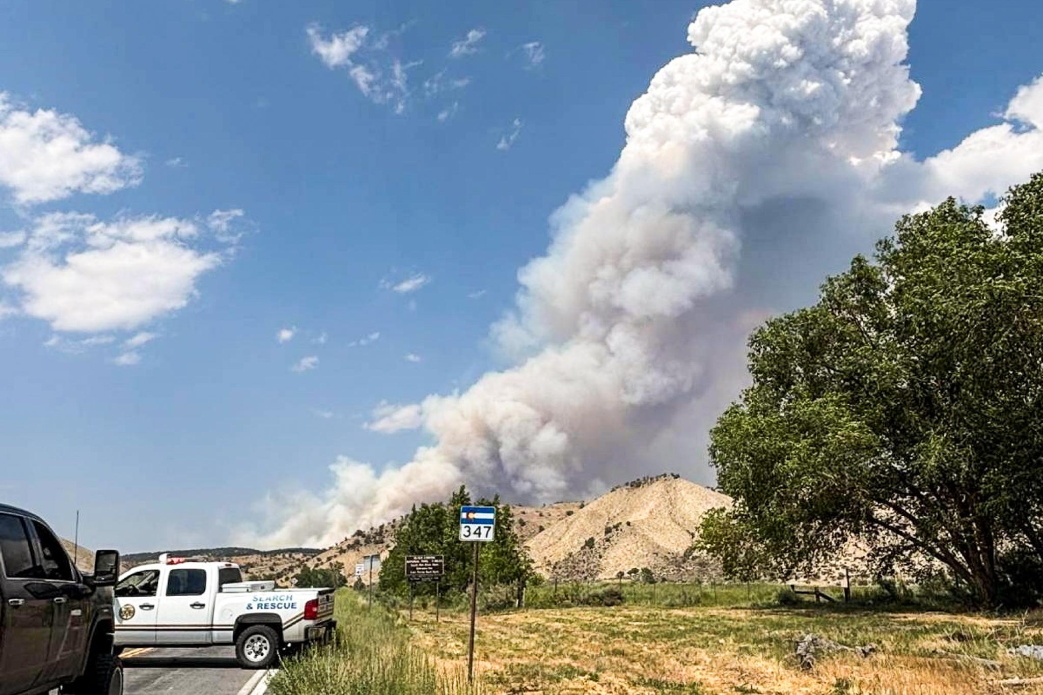
The fires is 30% contained, and Incident Commander Rich Harvey said the rain helped a lot, buying them time and opportunity today. He called the rain "fire trucks from the sky."
Audio of the 5 PM press conference:
The latest home assessment numbers from the El Paso County Sheriff: Total loss 419. Partial loss: 15. Appears unaffected: 2645. Here's where you can find information about individual properties. The assessment process is ongoing and subject to change.
There is a community meeting at Palmer Ridge High School, Saturday morning at 10 AM for residents.
6:30 PM
As of this evening, there are no mandatory evacuation areas west of Highway 83. In El Paso County, the eastern boundary is now Meridian Road (again) , although Meridian itself is not open to traffic. (In Elbert County, it extends a bit further to east, to Elbert Road.) The western boundary is Highway 83. To the north, borders are a little unclear to us at this time. To the best of our understanding, the northern border is either County Line Road (for the eastern half of the zone) or Walker Road (for the west half). The southern border is jagged: Shoup Road, Burgess Road, and Rex road. This citizen-drawn map appears to us to be the most accurate at the moment.
Areas that were under mandatory evac are now on pre- or voluntary evacuation, so residents there should remain ready to leave.
6:00 PM
The fire is 30% contained, says Incident Commander Rich Harvey. The count of houses lost is now 400. Authorities still have more than 2,000 houses to assess. The borders of the mandatory evacuation zone have been pulled back.
4:14 PM
The city of Colorado Springs has lifted the mandatory evacuations for Flying Horse and other northern parts of Colorado Springs. Those areas are now on voluntary evacuation. For the rest of the evacuation zone, outside city limits, previous orders remain in effect. See the city's map. But it looks like some residents can't immediately return. At 4:09 PM Sheriff Maketa asked for a delay on re-entry to the evac zone west of Highway 83. This applies only to areas outside the city limits.
Next press conference is at 5 PM. There's a 10 AM community meeting at Lewis Palmer High School Saturday morning. Containment remains at 5%. 389 homes now listed as destroyed. Here's the updated assessment list from El Paso County.
9:30 AM
Incident Commander Rich Harvey says the fire containment remains at 5%. "We didn't lose anything last night," he says. "We gained something. We're just not ready to quantify it yet." He advised an updated estimate may be available at today's 5 PM press conference.
6:30 AM
Next press briefing is at 9 AM. The El Paso County Sheriff's Office has released an updated list of home assessments, which you can find here. The numbers show 379 destroyed homes, up from 360 yesterday. Nine homes appear partially damaged, with 1813 as appearing unaffected. Assessments are ongoing and information is subject to change. Inciweb page now set up for Black Forest Fire.
Current evacuations listed below. For a map, click here.
El Paso County list of evacuations:
Mandatory Evacuations:
Hwy 83 east to Eastonville Road, from the El Paso County Line south to Burgess Road and Rex Road.
AND
On the west side…The western edge is Sun Hills Drive, Granby Drive, and Voyager Drive, from Baptist Road on the north, Vine Cliff Heights and Flying Horse Club Drive on the south, back to Hwy 83.
Southeast corner includes the area, from the corner of Rex Rd & Meridian Rd east to Eastonville Rd.
Preevacuation -
I-25 east to Hwy 83, from Northgate Blvd to Hwy 105, this area also has a Mandatory Evac area. See above.
Area 1 - Burgess Road south to Stapelton Drive, and Vollmer Road east to Meridian Road.
Area 2 - Latigo Blvd. south to Stapelton Drive, and Meridian Road east to Highway 24.
Area 3 - Guy Ranch Road south to Stapelton Road, and Eastonville Road east to Elbert Road.
Area 4 - Burgess Road south to Old Ranch Road and Poco Road, and Milam Road east to Vollmer Road.
Colorado Springs list of evacuations:
MANDATORY Evacuations
Northern Boundary: North Gate and Old North Gate Road
Southern Boundary: Flying Horse Club Drive (to include homes south of Flying Horse Club Drive on Barossa Valley Road and Veneto Way)/Vine Cliff Heights/Equinox Drive/Serenity Peak Drive
Eastern Boundary: Highway 83
Western Boundary: Voyager Parkway
Voluntary Evacuation
Area A: West to I-25 and all areas north of Old Ranch Road within the City limits of Colorado Springs (to exclude the mandatory evacuation boundaries mentioned above).
Douglas County Pre-Evacuations
There are no mandatory evacuations in Douglas County. Pre-evacuation notices have been issued for the extreme southeast corner of Douglas County: North of Black Forest which includes South County Line Rd (Douglas/El Paso Counties)north to Gillian Rd west to Hwy 83 and east to Elbert/Douglas County line.
Elbert County, as of 8:30 last night
Mandatory:
As of 8:00 pm last night, Elbert County residents residing between county road 74 (south Elbert
county line) and county road 86 and west of N. Elbert Road are still on mandatory
evacuation.
Pre-Evacuation:
All residents residing north of county road 86 to county road 98 and west of N. Elbert
Road may return to their residences on a pre-evacuation status. Pre-evacuation means
ready to evacuate upon a moment’s notice.
All other Elbert County residents may return to their homes at this time.
Previous updates:
Thursday Recap
Thursday PM Press Conference
Thursday morning