Editor's Note: This post collects all updates for Colorado's four major wildfires for Tuesday, Aug. 25, 2020. You can find the latest updates here. Our original post continues below.
As most Coloradans have noticed, the four major fires that burn across the state have taken a toll on the air quality. Smoke can irritate the lungs and make it harder to fight off an infection.
It's an inconvenient overlap given that this year's fire season has collided with the coronavirus pandemic.
"Exposure to the smoke does not make someone more likely to get COVID," said Colleen Reid, a geographer at the University of Colorado Boulder who studies the health impacts of wildfire smoke. "It could make them more likely to have a more severe case of COVID should they be exposed."
A recent study found bad flu seasons in Montana tended to follow bad wild fire seasons. Though it doesn't prove causation. Reid wasn't involved in that study and says it's an interesting result — but needs more investigation.
Here are the current statuses of Colorado’s four major wildfires (click on the fire name to jump to the updates):
- Grizzly Creek Fire: 32,060 acres, 44 percent containment (Aug 25, 8:44 a.m.)
- Pine Gulch Fire: 134,999 acres, 47 percent containment (Aug 25, 8:14 a.m.)
- Cameron Peak Fire: 20,118 acres, no containment (Aug 25, 9:18 a.m.)
- Williams Fork Fire: 11,266 acres, 5 percent containment (Aug 25, 7:18 a.m.)
- Other fires
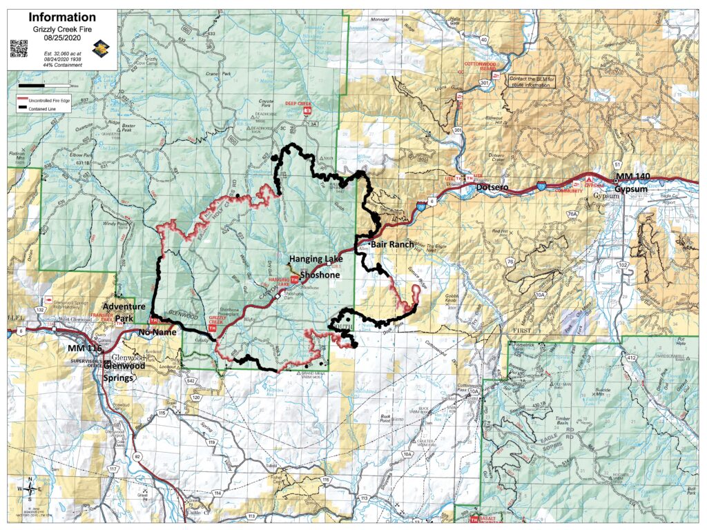
Grizzly Creek
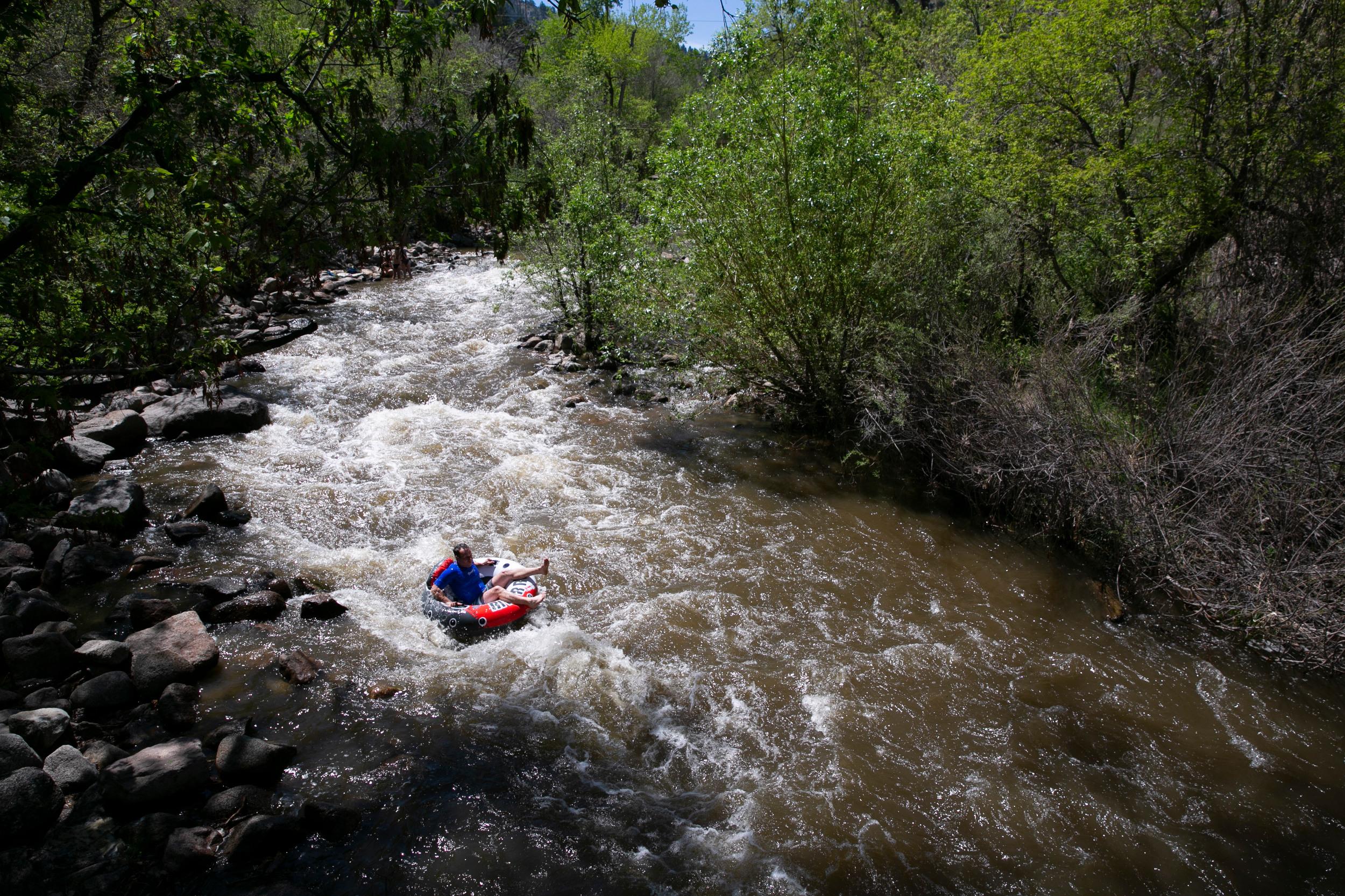
6:45 p.m.: People are starting to see the damage the Grizzly Creek fire has caused to Glenwood Canyon.
"There are a lot of dead trees and like skeletons of trees on top of the canyon walls, but the immediate canyon walls were not nearly as devastated as I had feared," said Kyle Jones, a Glenwood Springs resident.
The canyon's upper reaches appear to be most destroyed by the fire, Jones said. He passed the fire while tubing down the Colorado River, shortly after it started.
Although Interstate 70 has reopened, officials working on the fire said there is still no access to the river or trails, and people shouldn't expect to recreate in the area for a while.
The blaze has scorched 32,060 acres and is 44 percent contained.
A new management team will take over the fire on Wednesday. The cause of the fire is still under investigation.
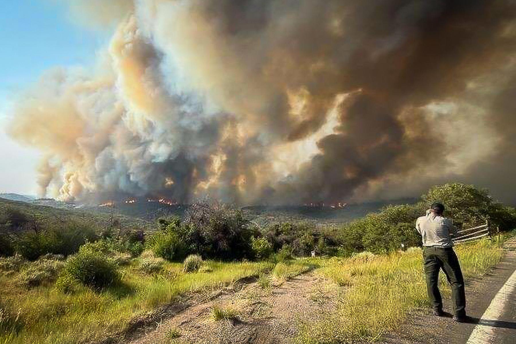
10:36 a.m.: Increased fire activity is expected for Tuesday due to unburned fuels inside of the perimeter and the wind. The forecast calls for a chance of thunderstorms and lightning in the evening.
Travelers along the newly reopened I-70 should expect to see smoke and flames and should not stop to look or call 911, according to fire officials. Travel in the canyon is still limited with reduced speeds. On Monday night, a flareup at mile marker 126.5 forced a temporary closure and helicopters attacked the flames.
Pine Gulch
6:48 p.m.: The Pine Gulch fire has burned nearly 135,000 acres and is almost 47 percent contained. Although containment has increased, road and recreation closures are still in place.
1:49 p.m.: Pockets of blue sky started to emerge Monday in Grand Junction after smoke filled the air for weeks. The National Weather Service says gusty winds could quickly blow more smoke in any direction. The Pine Gulch Fire is about 18 miles away, and officials say it is not a threat to the small city. However, several homes in rural areas closer to the fire have been evacuated and many more are on pre-evacuation notice.
— Stina Sieg
9:39 a.m.: Officials say aircraft will have a big presence Tuesday in the area of the north front of the fire. The air support is intended to slow the fire as crews and dozers reinforce and build fire control lines.
Thunderstorms and wind are expected in the afternoon, with little chance of rain.
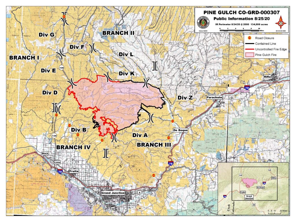
7:21 a.m.: Growth of the Pine Gulch fire, north of Grand Junction, has slowed considerably. It still remains the second largest fire ever in the state. The National Weather Service says there's a chance for scattered showers in the area later this week.
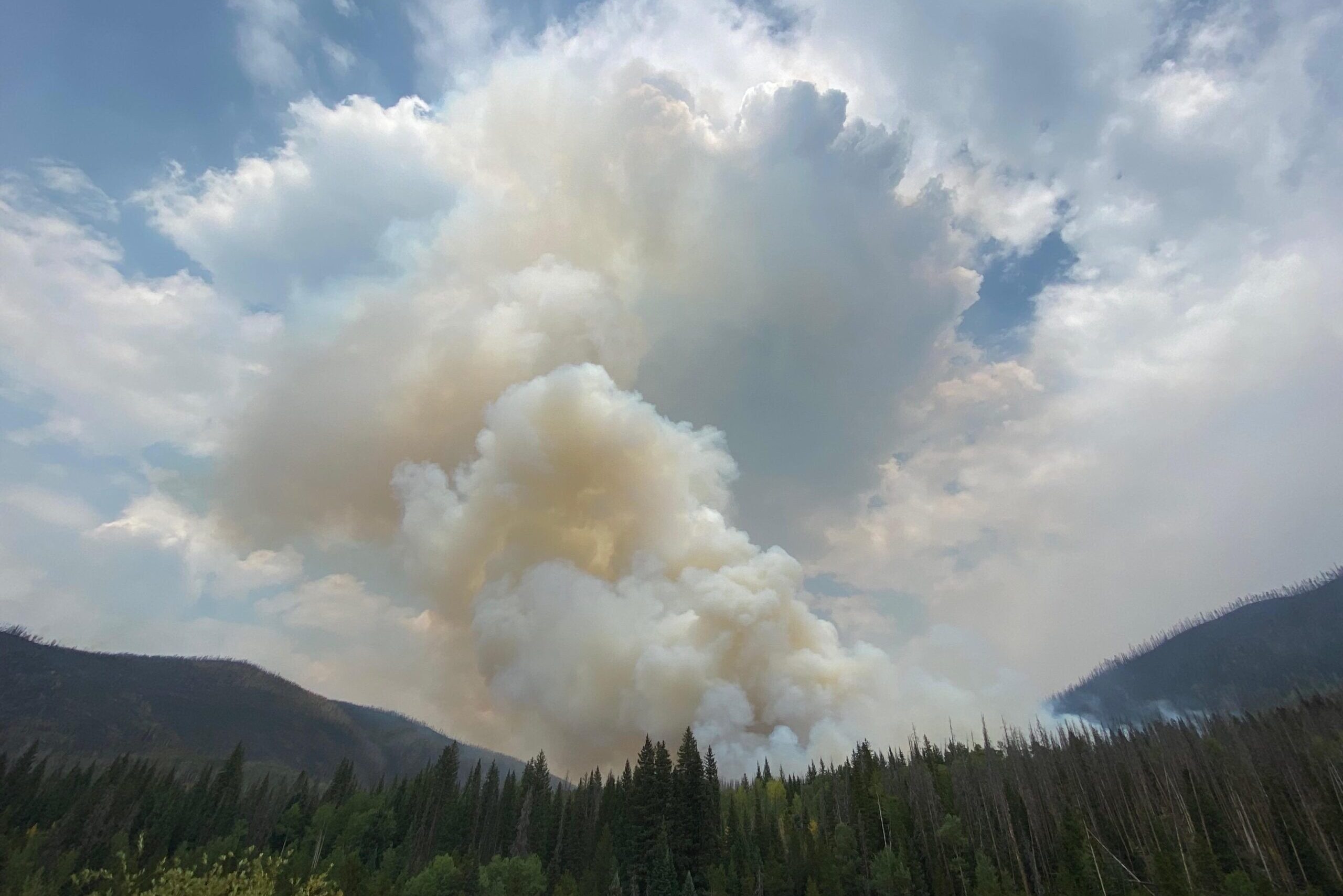
Cameron Peak
3:56 p.m.: Officials have estimated that the fire is burning within a mile of Rocky Mountain National Park's northwestern boundary.
"The Long Draw Road area was one of the area's with the most activity yesterday," Jake Livingston, operations section chief for the team managing the fire, said in a video briefing posted late Tuesday morning. "We have personnel monitoring that and watching its proximity to the Rocky Mountain National Park."
Williams Fork
The Williams Fork fire west of Winter Park is about 5 percent contained. A burning operation along CO Roads 3 and 30 covered about 600 acres and helped raise the containment around the fire.
"The good news is over the next few days we're expected to get maybe up to a quarter inch of rain over the next three days or so," said Mike Johnston with the team managing the fire. "So favorable weather ahead of us, I don't expect much fire growth over the next few days."
Other Fires
Willis Creek
This fire is in Pueblo County, about 1.5 miles to the northeast of Lake Isabel.
Thorpe
This fire is located in Park County, just two miles southwest of the unincorporated town of Tarryall.
Lewstone
The Lewstone fire started Aug. 22 about 15 miles northwest of Fort Collins.