Updated 4:51 p.m.
Larimer County officials have closed the Poudre River for all uses following the deadly flood in Poudre Canyon. Debris from the flash flood, including trees, mud, and pieces of buildings, flowed into the river, creating dangerous conditions.
“This restriction applies to all watercraft craft and the restrictions are being imposed in response to disaster relief and debris removal relating to the flooding and mudslides into the Poudre River near the Black Hollow Road bridge that occurred on July 20," the county said in a statement.
The river restrictions will likely last through the weekend. More rain is in the forecast, creating the potential for more flooding.
State Highway 14 near the canyon has reopened, but the U.S. Forest Service has closed all campgrounds in the area, said Jered Kramer, a spokesperson for the Larimer County Sheriff's Office.
A large swath of Colorado is under a flash flood watch Wednesday as authorities search on foot and with aerial drones for three people who went missing during an overnight flash flood in the upper part of Poudre Canyon.
One woman was killed and at least five homes were destroyed in the flooding, according to the Larimer County Sheriff’s Office. Two adults are still missing. The American Red Cross will continue to staff a site at Cache La Poudre Middle School in case there are more evacuations Wednesday.
Karen McClure, a volunteer with the Northern Colorado chapter of the American Red Cross, spent Tuesday night at the middle school evacuation shelter. She estimated about 15 to 20 people came in for information, but nobody stayed overnight. She said the last visitors arrived shortly before 11 p.m., when evacuation orders were lifted.
“Mainly who showed up were individuals who were camping up in the area and they had their pets. Red Cross does not take pets into an overnight shelter situation, so it ended up being more of an information gathering area or evacuation center versus an overnight shelter,” McClure said.
The flooding occurred west of Fort Collins in an area scorched last year by the Cameron Peak Fire, the largest recorded fire in Colorado history. An inch of rain fell in half an hour, enough for debris from the burn scar to flow downstream and flood homes and campsites, said Jennifer Stark, meteorologist in charge for the National Weather Service offices in Boulder.
“A whole inch of rainfall really is not that much,” Stark said. “Most of us would prefer to see that on our lawn or on our garden, but when it falls on these burned areas it’s very, very dangerous and deadly.”
Burn scars are more susceptible to flash flooding in the first two years after a wildfire, according to the National Weather Service. Rain flows more quickly through burned areas that have fewer plants, less tree canopy and more exposed soil. This rapid flow of water can pick up logs and other dangerous debris. Plants burned in wildfires can also coat soil with a waxy substance that repels water instead of absorbing it.
“Sometimes it’s just one heavy rainfall event and that breaks that dam of debris loose and the whole thing can come down,” Stark said.
Colorado’s atmosphere has much more moisture during the monsoon season, increasing the likelihood that thunderstorms come with rainfall, Stark said. The weather service monitors when storms move over burn scars, she said, issuing flash flood warnings if as little as a third of an inch of rain falls in 30 minutes.
More than 600,000 acres burned in Colorado last year, according to data from the National Interagency Fire Center. Hotter and drier conditions worsened by climate change could put more of Colorado at risk of wildfires and the subsequent flooding in burn scars.
The Cameron Peak Fire and East Troublesome Fire burn scars are under a flash flood watch until 8 p.m. Wednesday.
Southwest Colorado and portions of central and southeast Colorado are also under a flash flood watch through the evening.
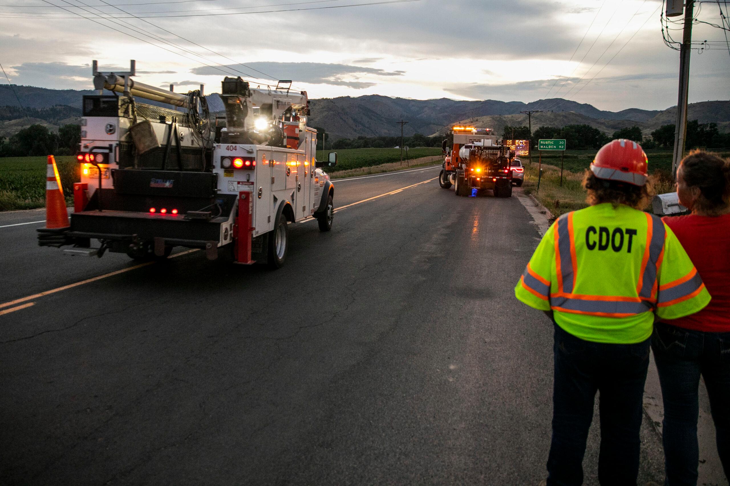
The Colorado Department of Transportation is also warning motorists about the possibility of flash flooding from the Grizzly Creek burn scar. Interstate 70 is closed due to the flooding risk and to allow crews to clean up multiple mudslides.
This is a developing story and will be updated.