Remembering Waldo Canyon fire | A fire expert reflects on Colorado wildfire history | Waldo was a catalyst for mitigation | Lessons learned by Colorado Springs
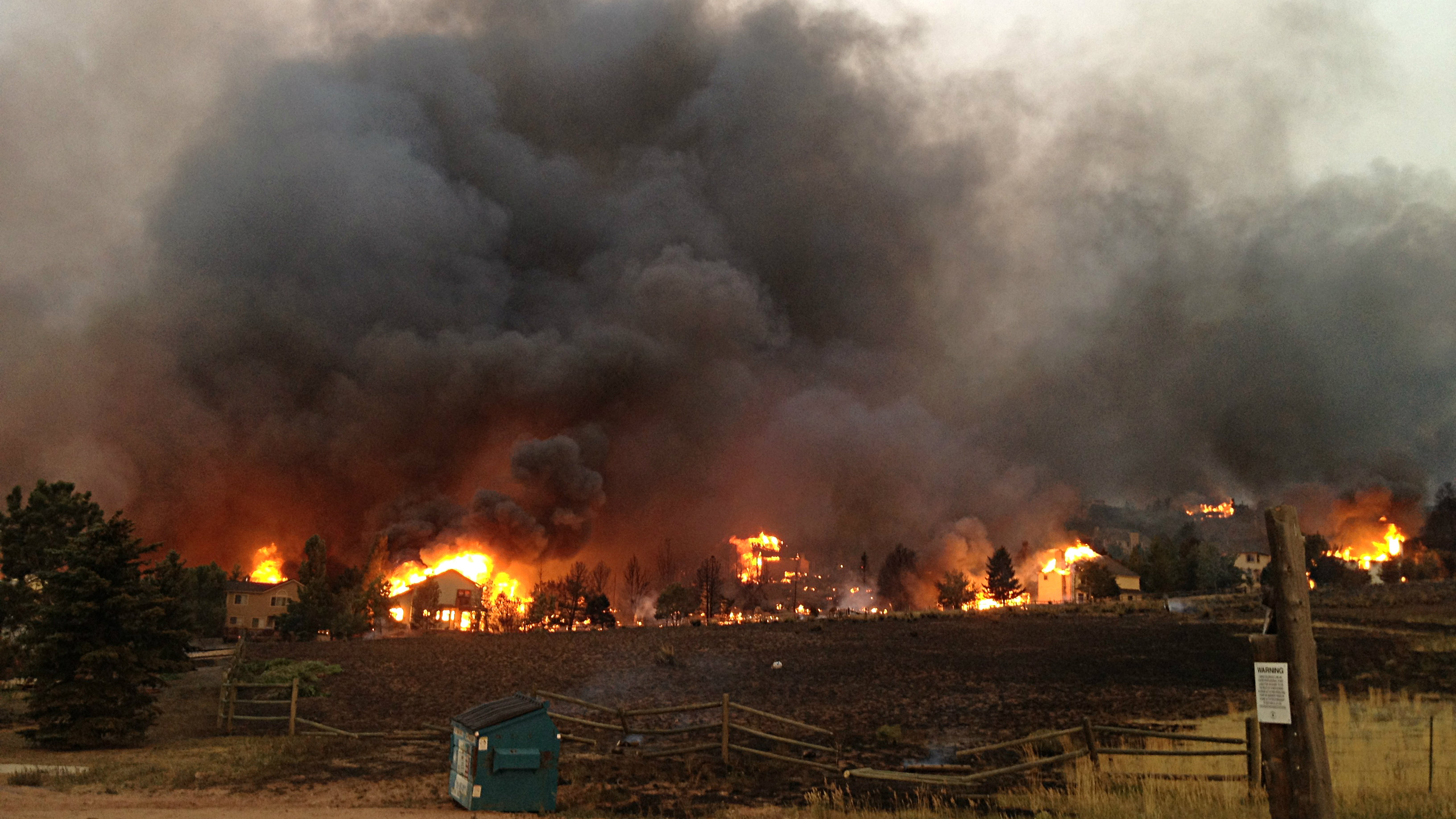
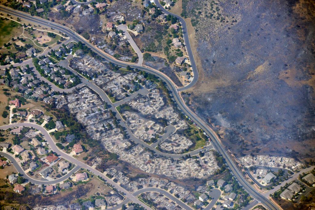
Ten years ago, the Waldo Canyon fire started near Colorado Springs and within days had torn through the Mountain Shadows neighborhood on the west side of the city and the hills behind it. Two people died and 346 homes were destroyed.
At the time, it had become the most destructive wildfire in state history, surpassed the following year by the Black Forest fire. That title is now held by last year's Marshall fire in Boulder County.
Officials determined it was human-caused, but the investigation into the details of the Waldo Canyon fire is still open. Investigators say the point of origin was within three miles of the Waldo Canyon Trailhead off Highway 24, west of Colorado Springs.
At the time, current Colorado Springs Fire Chief Randy Royal was responding to a call in Garden of the Gods when reports came in about smoke on the side of the mountain.
"I looked up and it was right in front of me. It was a really tight column that was going straight up," Royal said. "As soon as I saw it, I knew it was gonna be a bad deal."
He said the first six days of the fire were nonstop for firefighters.
"There was a point on Saturday, the 23rd, that it had made a run into Cedar Heights [and] if we hadn't been able to have been there all day long working, we would've lost houses up there," he said.
The nearby towns of Green Mountain Falls and Manitou Springs were spared, mostly because of weather, Royal said. Both towns were evacuated.
"That fire changed directions over those initial days. When it was really going to town, it changed directions three or four times and there was a point where we were thinking about Manitou and Green Mountain Falls, that whole area, being impacted like we saw with Mountain Shadows," he said.
Smoke from the Waldo Canyon fire was first reported on June 22, 2012 but it wasn't located until the next day. By the time it was fully contained, the fire had burned just over 18,000 acres and caused more than $352.6 million in damage. At its height, over 30,000 people were evacuated from the Pikes Peak region.
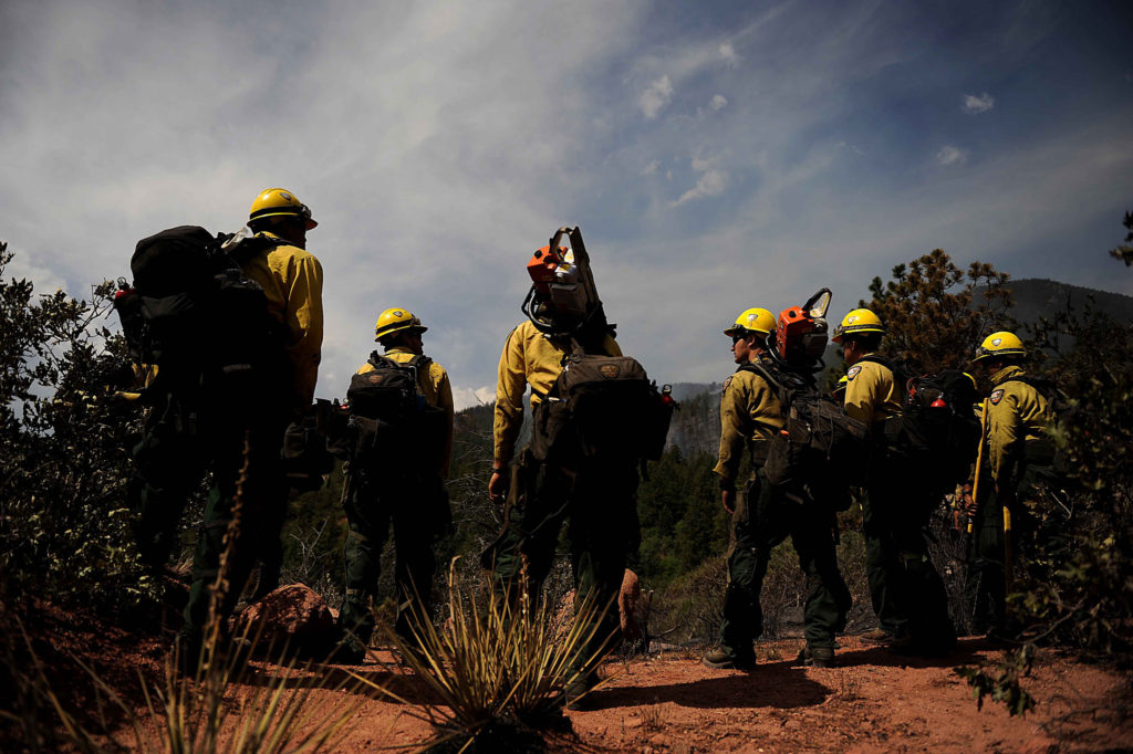
(Courtesy USDA/via Flickr)
In this 2012 photo, firefighters form a fire line at the Waldo Canyon Fire in Colorado Springs.
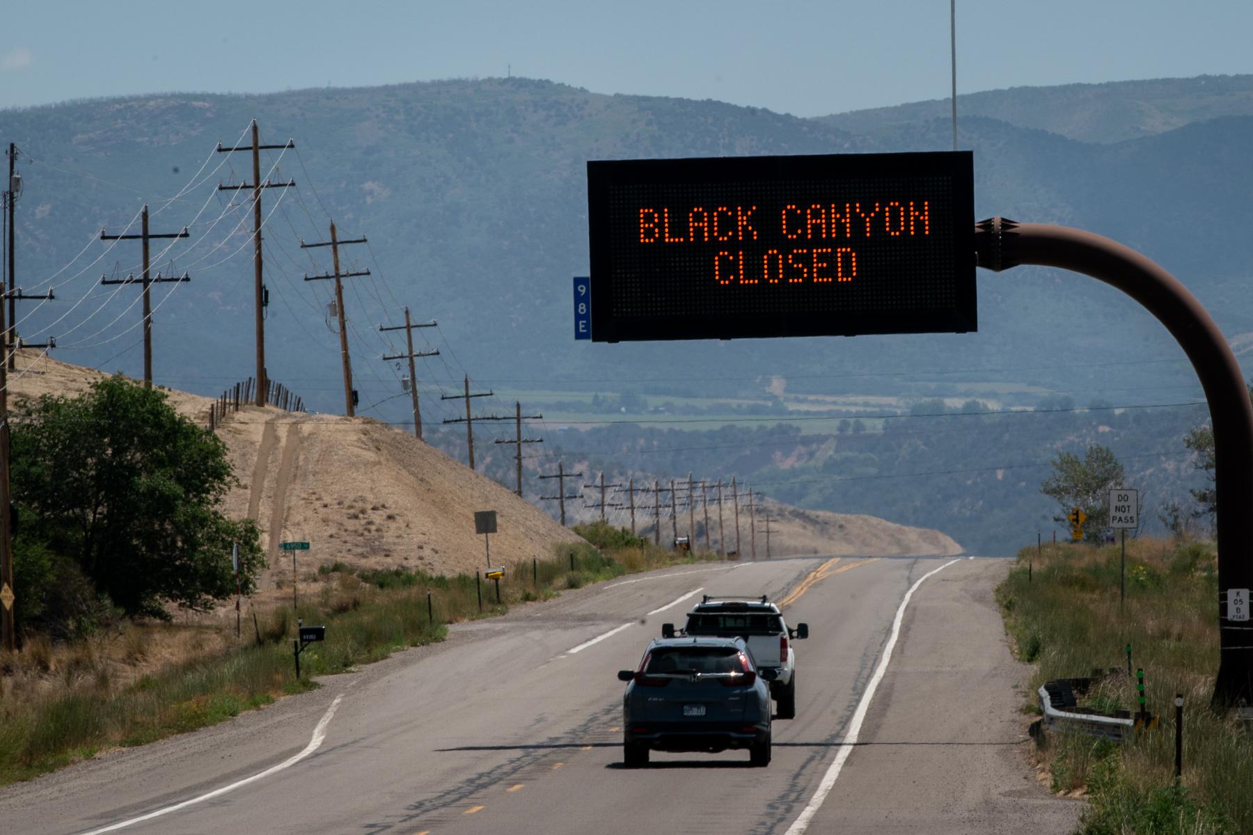
Colorado Springs has roughly 35,000 homes in the wildland urban interface, or WUI. That's often defined as where human development meets wildland areas.
Royal said living in a WUI is comparable to living in other cities prone to natural disasters, like L.A. for earthquakes and New Orleans for hurricanes.
"If you live in the WUI, you need to understand that you live in a higher risk area than other people in the community. One of the things that we harp on all the time is mitigation and that's working both with your own home and with your neighbors in your community because there's certain things you can do to protect your home," he said.
The Colorado State Forest Service recommends removing all leaves, needles and other debris from decks, roofs and gutters as well as creating a defensible space by reducing fuels around homes.
Royal said it's also key for residents to have an evacuation plan.
"[Having] the Waldo Canyon fire and then less than a year later, the Black Forest fire, that was a big loss to our community - just under 1000 homes between those two fires," he said. "Being fire safe and being aware of weather conditions and those types of things helps us out."
The Colorado Springs Fire Department has a tool homeowners can use to assess their individual risk.