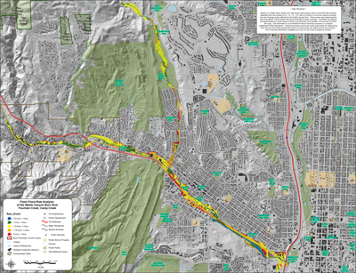
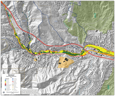


Colorado Springs and El Paso County officials have released updated flood maps for areas in and near the Waldo Canyon burn scar. The maps detail expected flood effects after one-hour rainfall amounts of a half-inch up to two inches of rain. The assessments assumed debris in floodwaters would cause blockages at street crossings. Maps include Ute Pass, Manitou Springs, and Fountain Creek. Douglas Creek maps have not yet been updated. There’s a preparedness meeting tonight at six for residents and businesses along Fountain Creek at Al Kaly Shrine.
For more detailed and zoomable maps, click the following links (.pdfs may take a while to load):
Fountain Creek & Camp CreekEast FountainUte Pass: Cascade and Chipita ParkLower Ute PassManitou Springs