
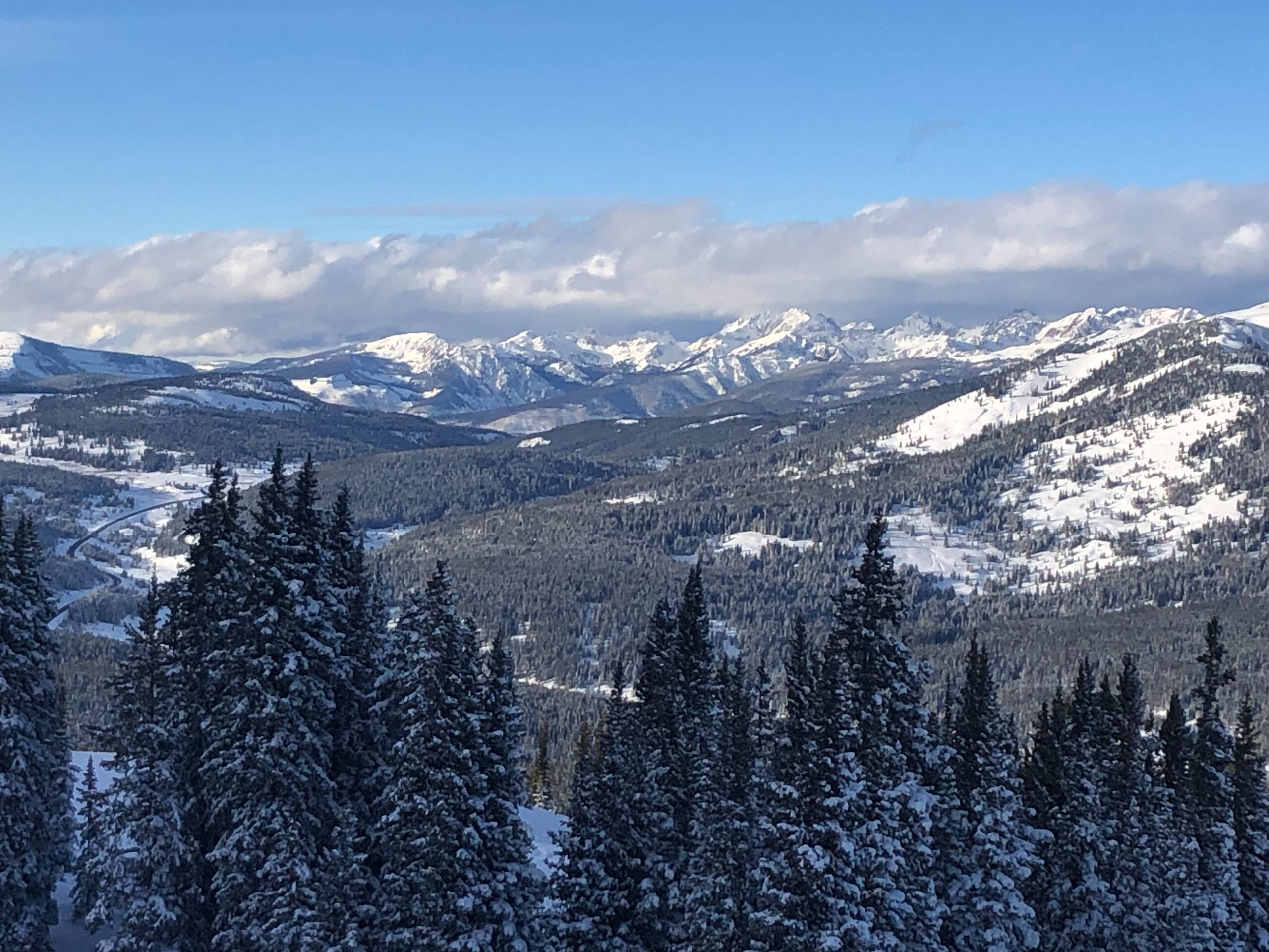
Winter storms over the Christmas weekend brought big improvements to the amount of snow collecting in Colorado’s mountains.
Statewide, the snowpack is now 108 percent of what’s normal for this time of year. At the start of December, it was around 50 percent, according to data from the Colorado Snow Survey Program — a slow start that set records in Denver and disappointed mountain skiers and boarders.
The rapid reversal of low snow levels in the early winter weeks has also brought high avalanche danger, which will continue into the New Year holiday weekend as more snow is forecasted to hit the high country.
Lucas Boyer, a meteorologist with the National Weather Service in Grand Junction, pointed to the Crested Butte area as one example of an extreme snowpack turnaround. At the start of December, two inches of snow had accumulated in the area. Now there are 45 inches of snow. Half of that fell over the Christmas weekend, which Boyer said was significant.
The Colorado Avalanche Information Center said that more than 200 avalanches were reported over the Christmas holiday. Eight people were buried and one backcountry skier was killed. Forecasters say more snow is on the way, which Boyer said will likely bring similar amounts to what fell during the Christmas weekend.
The snowy forecast has prompted the avalanche center to send out a strong warning: Do not travel through backcountry avalanche terrain through Sunday.
"We're gonna be seeing large avalanches releasing spontaneously,” said Ethan Greene, the center’s director. “We could see trees destroyed, avalanches running into the valley bottoms. These are very dangerous avalanche conditions."
The avalanche danger level will likely rise to “high” Thursday for areas around Steamboat, Aspen, Gunnison, Grand Mesa and South San Juan Wilderness area. Greene said there’s a chance that conditions could increase to a rare “extreme” danger warning by Friday, the most hazardous level. Greene said a small number of extreme events have happened over the last 20 years.
The latest data on snowpack in Colorado’s basins show snowpack — layers of snow that accumulate in an area — have improved across the state compared to average levels recorded from 1991 to 2020. On the Western Slope, levels in the Gunnison basin are 132 percent of normal snowpack, followed by 124 percent for the San Miguel, Dolorse, Animas and San Juan basin. The Upper Colorado Headwaters is at 112 percent and the Yampa and White is now at 105 percent.
Snowpack in the South Platte on the Eastern Slope is 95 percent of normal, with the Arkansas basin at 80 percent and the Upper Rio Grande at 88 percent.
The treacherous avalanche conditions are fueled by large snow loads falling on weak and thin snowpack, Green said. Snowfall has also been heavy and full of moisture, which adds a lot of weight on the snowpack.
“And that snow came in really fast and furious,” Greene said. “We’ve essentially gotten two or three times the snow that we had on the ground in just the last week.”


