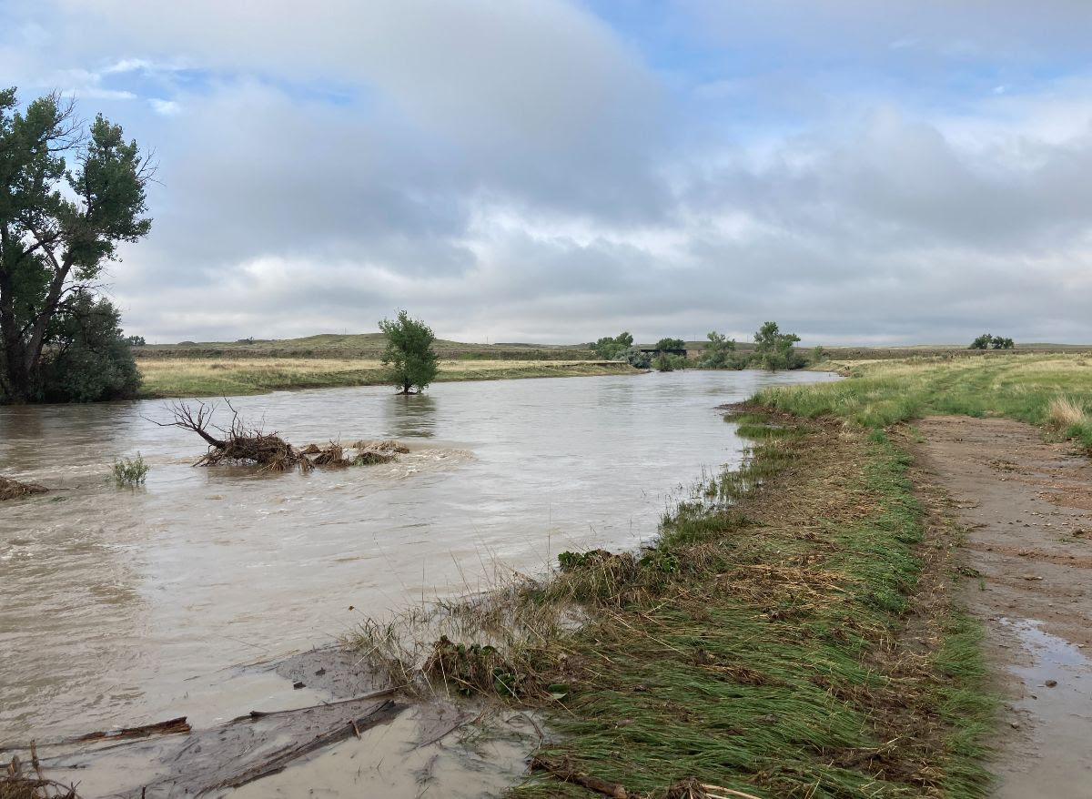
A fast-moving storm system dumped up to 2 inches of rain in parts of the Denver metro area Tuesday night, causing minor flooding on some local roadways. Showers also drenched parts of Southern Colorado and the Eastern Plains.
Colorado Parks and Wildlife shut down the Flagler Reservoir State Wildlife Area in Kit Carson County on Tuesday after the reservoir overflowed and flooded a nearby county road. The closure will last until flood waters recede, said CPW’s acting director Heather Dugan in a statement.
“We are closing it to protect the public,” Dugan said. “It is not safe to drive on a county road that crosses the dam, and CPW is concerned about the houses below the dam in the event we get more rain in the area later this week, as forecasted.”
No weather-related injuries have been reported so far. Still, forecasters are warning residents of the continued threat from flooding, especially in communities near burn scars from recent wildfires.
Expect flood and severe thunderstorm warnings to pop-up through the rest of the week. The stronger storms will be capable of producing “1 to 2 inches of rain in 30 minutes,” according to the NWS.
The NWS’s Pueblo office is warning El Paso County residents there’s a potential for flash flooding and up to nickel-sized hail Wednesday afternoon and evening.
Scattered showers are in the forecast every evening through the weekend for most of the state. The greatest potential for slow-moving storms in higher terrain areas along the Front Range will come Thursday and Friday evenings, according to the NWS.
“Burn areas produce flash flooding in as little as a third of an inch,” said Bernie Meier, forecaster with the NWS’s Boulder office. “Five or ten minutes of rain can produce some minor flooding and things can get bad quickly.”
The late-July monsoon weather is a pretty typical weather pattern for Colorado. The season has been abnormally dry the past two years, though, which may make this week’s storms a surprise for some, Meier said.
“We've kind of missed out the last year or two,” he said. “But it should hopefully help with drought conditions.”
Temperatures will continue to be cooler than last week’s heat wave. Highs in the Denver area and Grand Junction are forecast in the mid-to-upper 80’s through Saturday. Colorado Springs and most mountain communities can expect highs in the 70’s.