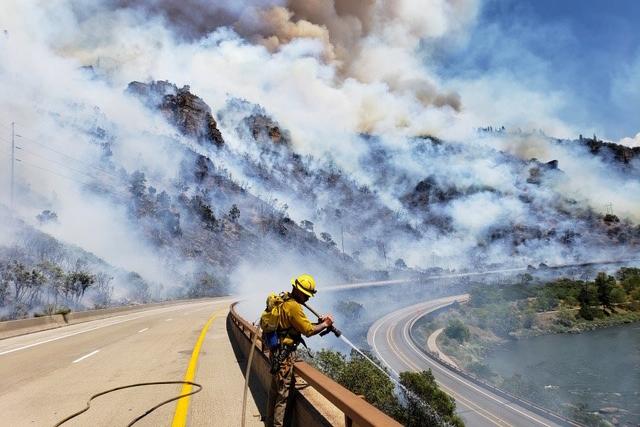
In summer 2021, traffic in Glenwood Canyon came to a halt as mud and debris covered Interstate 70. Heavy rain on the Grizzly Creek Fire burn scar moved the dirt and rocks, trees and other material and made the highway impassible.
The road remained closed for weeks, and after it reopened, there were several shorter closures whenever rain came to the area. The problem: Burnt soil doesn’t soak up water as well as undamaged soil, so any rain that fell on the burn scar would flow onto the road, pulling debris with it.
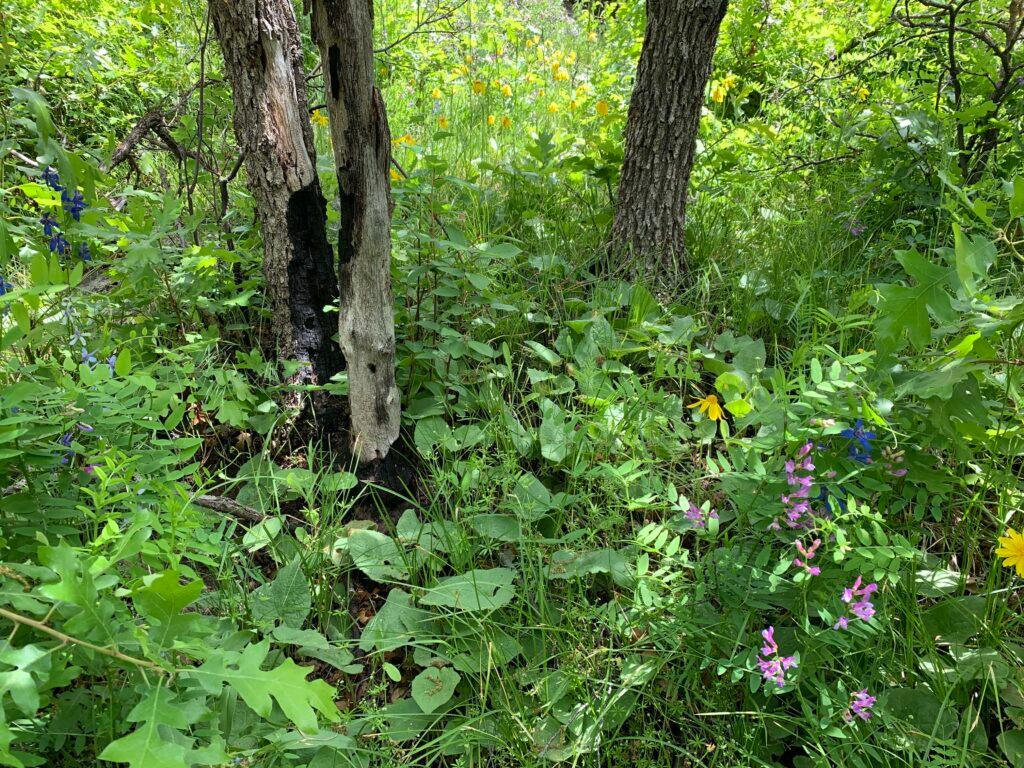
Two years later, the burn scar is in much better condition — where charred soil once was, a healthy amount of trees and plants are now growing. But there’s still work to do.
“There's a few areas where, especially in the timber where it burned more severely, it's hard to do much in that, because all the microorganisms and those sorts of things were destroyed,” said David Boyd, public affairs officer for White River National Forest. “So there's a few areas where we can get to this summer that we're gonna put some mulching down.”
The continued recovery of the Grizzly Creek Fire burn scar is good news for commuters, too. Last year, officials would close the roads whenever a flood watch was issued by national weather forecasters. Each year, the Colorado Department of Transportation, United States Geological Survey and the National Weather Service work together to adjust what threshold would trigger a flood warning or flood watch.
“This year looking at the regrowth and how everything went last year, we bumped everything up,” said Todd Blake, a deputy maintenance superintendent for CDOT. The new thresholds to trigger flood warnings “will be one inch in an hour and then it'll be 0.6 [inches] in 30 minutes.”
CDOT, USGS and the NWS think the higher thresholds will reduce closures caused by inclement weather along I-70 in Glenwood Canyon by 50 percent.
For bike paths and rest areas, CDOT has also considered the probability of the storm reaching the level of rainfall predicted. Last year, if there was a 30 percent or greater chance of hitting those trigger points, they would close bicycle paths and rest areas the night before the storm was about to pass. This year, the agencies have increased it to a 50 percent or greater probability.
“That's just because it's 16 miles of bike path plus four rest areas and nobody has the personnel to go in and try to move that many people out for search and rescue,” Blake said.
It’s been rainy in the canyon, but peak rain season is on the horizon
It’s been a rainy couple of months for Colorado, and the canyon is no different. Over the last 60 days, Glenwood Springs and the surrounding area has received about three inches of rain — about average for this time of year.
I-70 hasn’t been forced to close through the Valley so far this year, but Blake warns closures could be coming as monsoon season starts soon.
“June, it's really early,” Blake said. “You have to have the really warm days to raise the temperatures and convection and all that over here. So we typically don't see heavy rains until this time of year moving forward.”
CDOT urges people traveling through Glenwood Canyon to keep track of weather and potential closures before they travel.