Updated at 2:12 p.m.
A variety of flood notices are in effect Monday as weather officials brace for strong downpours this afternoon.
Skies were sunny and blue Monday morning, but that quickly turned to storm clouds by the early afternoon. National Weather Service meteorologist Caitlyn Mensch said the brief period of warmth this morning created conditions ripe for rain and thunderstorms along the I-25 corridor.
“All it took this morning was just a couple hours of some sunshine and broken cloud cover just to create enough instability to get a lot of this stuff running again,” Mensch said. “We have plenty of moisture around to support it.”
The NWS has issued several different kinds of notices for the Front Range and Southern Colorado related to the rain, ranging from “Flash Flood Warning” to “Flood Watch” to “Flood Warning.”
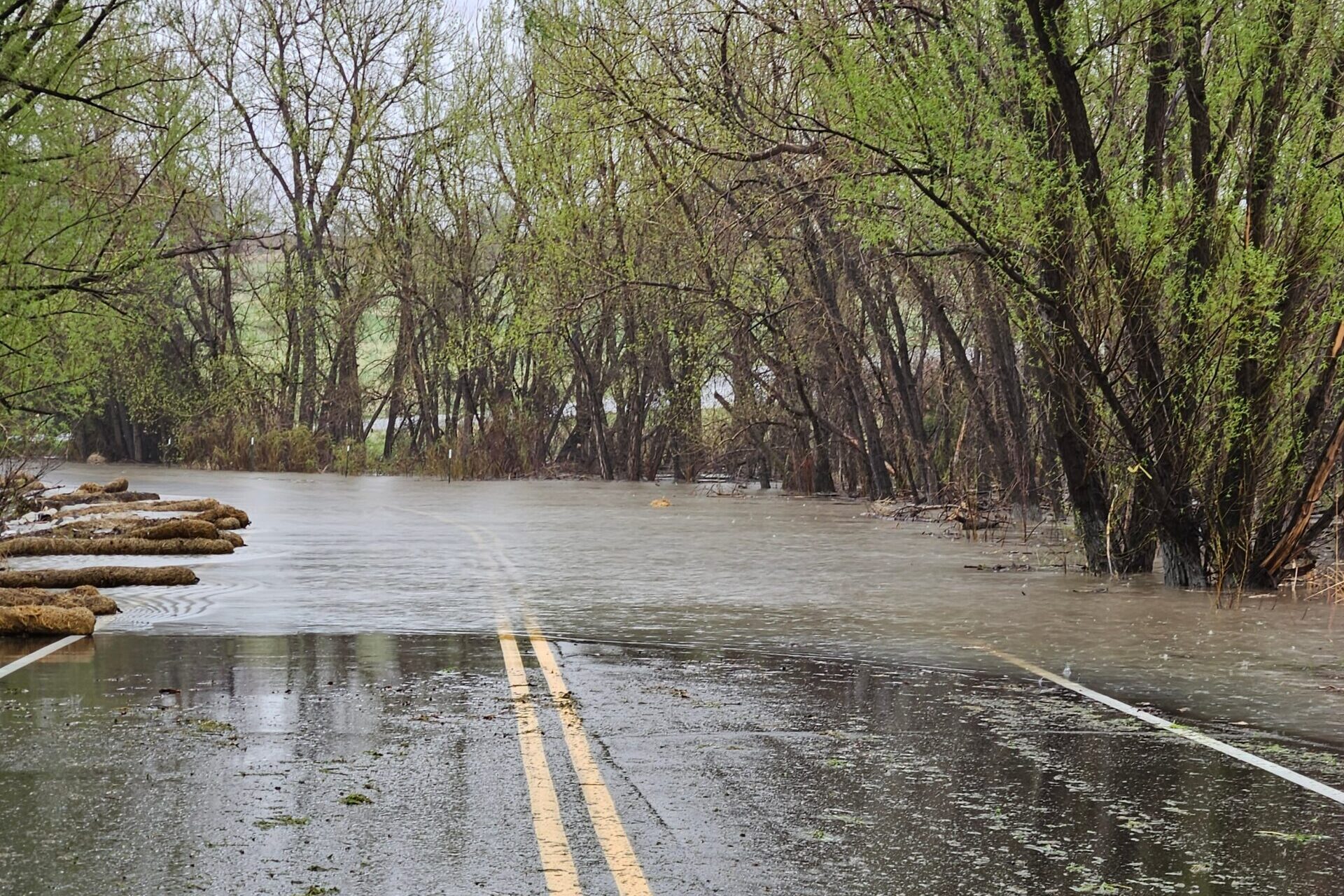
While all mean different things for meteorologists, the message for the general public is essentially the same: Be on the lookout for flooding on roads, especially near streams of water.
Many rivers in the Front Range are already overflowing due to previous rainfall and snowmelt. Warnings are in effect for areas close to the Arkansas River in Pueblo, Fountain Creek in Southern Colorado and East Bijou Creek in northeast Colorado. The Colorado River, which flows through the Continental Divide, is also expected to overflow and flood low-lying areas nearby.
Weather officials are warning residents to turn around if they come across flooded roads. Just a few inches of water can be enough to make a vehicle stall, potentially leaving the driver stranded.
Areas close to burn scars will also be extremely vulnerable to flooding.
“Those areas as we know are very, very sensitive to rainfall,” Mensch said. “So even though they're not experiencing as heavy rainfall as we might be seeing over the plains right now, or even the foothills, it doesn't really take much in a short period of time to fall to cause impacts in those areas.”
All flash flood warnings are due to expire by 3:15 p.m. Monday, but Mensch said rain is expected to continue throughout the week, albeit at a lesser frequency.
Colorado has grown accustomed to the rain in recent weeks. Since last month, most urban parts of the state have received at least two inches of rain, according to Colorado State University measurements. Some areas, including Fort Collins and parts of the Eastern Plains, have seen upwards of four inches of rain.
In addition to flood warnings, the NWS has issued advisories on severe thunderstorms and tornadoes in Southern Colorado. Forecasters say thunderstorms near Pueblo could produce golf ball size hail and extremely strong gusts of wind. The NWS says those same storms are capable of producing a tornado.
Residents are advised to stay indoors. The combination of strong winds, hail and possible tornadoes could result in injury to people or damage to property.
Travelers flying through Denver International Airport are being warned that thunderstorms could cause delays. As of early Monday afternoon, there were 596 delays with 31 cancellations for flights entering and leaving DIA, according to flight tracking website FlightAware.