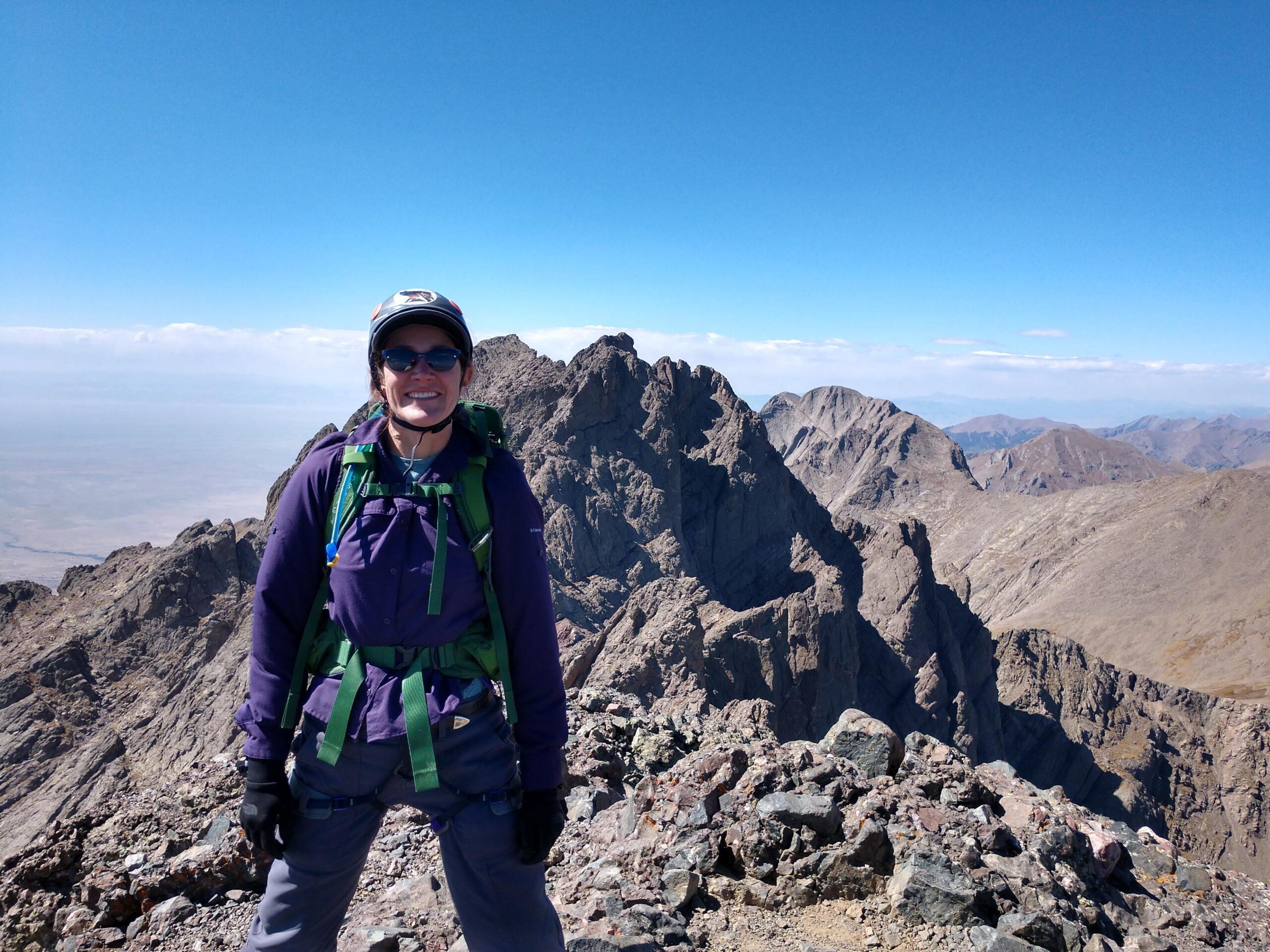
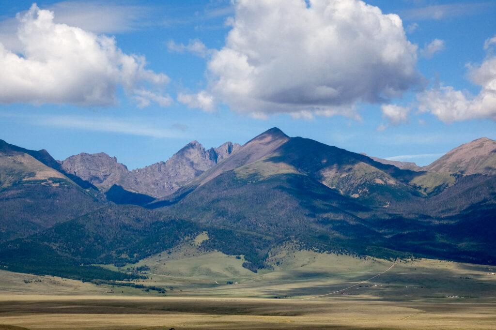
Five spectacular 14,000-foot peaks in Southern Colorado’s Sangre de Cristo mountains are also perilous. Known as the Crestone group, these peaks regularly claim the lives of climbers and hikers and are the site of dozens of rescue missions.
Now, Custer County Search and Rescue — which responds to calls for help in the backcountry of the Wet Mountain Valley near Westcliffe, about an hour west of Pueblo — is using GIS mapping technology to identify dangerous climbing patterns on the five 14’ers: Crestone Needle, Crestone Peak, Kit Carson Mountain, Challenger Point and Humboldt Peak.
It’s a project that started last year when Emily Griffith Technical College student Kim Jones Thomas began mapping six years of search and rescue mission data for the Crestone group. The map she created shows where fatalities, life-saving and other kinds of missions happened and includes other information about each situation — like the number of people in the group and what they were doing on the mountain.
She found incidents often clustered in certain areas, usually when climbers were descending from the summit. The number of rescue missions for people who were on their way down was more than double that for those going up.
“It's not that these people don't know what they're doing,” Thomas said. “It’s just (that) the terrain definitely leads to being confused, especially at that altitude, and you're tired (and) dehydrated. It's easy to make mistakes up there.”
Longtime CCSAR member Cindy Howard said problems often occur when climbers get off route after reaching a summit. Especially if they are alone.
“The best thing to do when you're descending and you realize you're off route is to regain that elevation,” she said. “A lot of times people don't want to. They're tired, they just want to get down.”
People need to remember that getting to the top of a mountain is only half the trip, Thomas said. “So while you celebrate that you made the summit, you still have to get home.”
Mapping mission data highlights terrain traps and other critical information that rescue teams can later use, according to Howard.
“It helps us with our mission pre-planning,” Howard said. “We know where certain things happen.”
It also validates some of what they already had observed about the dangers of hiking in these places but had not tracked, Howard said. They knew there were a lot of navigation issues on Kit Carson Peak and Crestone Peak, for instance, and that they often happened when people were coming down a different way than they’d gone up.
“We know that there are terrain traps that we look for on missions on any of the peaks, couloirs or cliff bands where people get in trouble,” Howard said. “So by actually plotting them and mapping them, we were able to see patterns where individuals became cliffed out in a certain spot or if they fell, they potentially fell from a spot where others have become cliffed out.”
Cliffed out means to get into terrain that is so technically challenging that a person can neither go up or down from where they are.
It’s vital that people understand and consider the risks they are taking as inherent to climbing and mountaineering, according to Thomas.
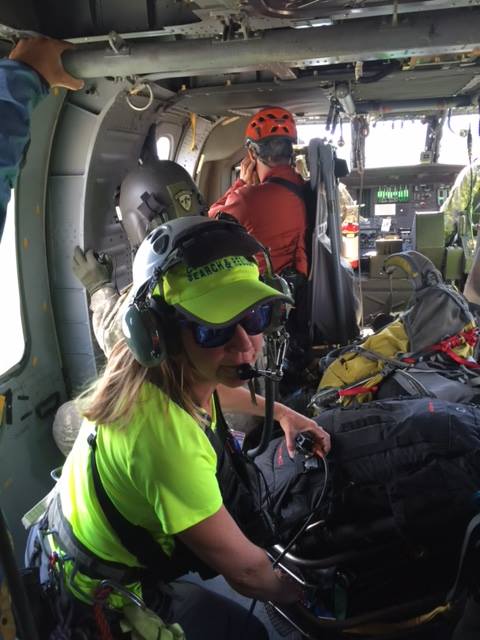
“It's not, just make a call and a helicopter is going to be there to pick you up in half an hour,” she said. It often takes hours for search and rescue teams to reach you and assess the situation, and a helicopter rescue is not always possible depending on multiple factors.
Howard said it’s crucial for backcountry users to have good navigation skills, acclimate to high altitude before they climb, and that they carry survival supplies.
Carry these ten essentials, she said, because it’ll help you stay alive if you get in trouble:
- Navigation – Map, compass, and GPS system - and know how to use them before you head out
- Sun protection – Sunglasses, sunscreen, and hat
- Insulation – Jacket, hat, gloves, rain shell, and thermal underwear. Also, have an extra layer of clothing that reflects the most extreme conditions you could encounter.
- Illumination – Headlamp is preferred because it’s hands-free, along with extra batteries
- First-aid supplies – Start with a pre-made kit and modify it to fit your trip and your medical needs. Check the expiration date on all items and replace them as needed. Consider including an emergency guide in case you are faced with an unfamiliar medical emergency.
- Fire – Matches — preferably waterproof — a lighter and fire starters.
- Repair kit and tools – Duct tape, knife, screwdriver, and scissors and/or multi-tool
- Nutrition - Food, preferably no-cook items that have good nutritional value
- Hydration – Water and water treatment supplies
- Emergency shelter – Tent, space blanket, tarp, and bivy
Editors note: This story was updated to reflect the source for the ten essentials list above which is excerpted from the National Park Service website