Where things stand right now, with the East Troublesome and Cameron Peak fires
- Weather: Snow is good for the fire — but bad for pipes in evacuated homes
- What we know right now: Sheriff confirms two deaths in Grand Lake
- Rocky Mountain National Park: How bad is the fire damage to RMNP?
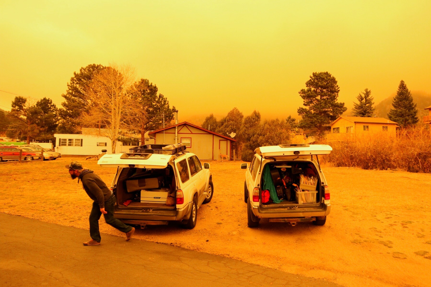
- Photos: What our reporters are seeing, from Grand County to Estes Park
- Maps, resources, evacuation information and more
This page was last updated Friday, Oct. 23 at 1:30 p.m.
Live Updates On The Cameron Peak Fire
- Cameron Peak Fire Facebook page
- Cameron Peak Fire InciWeb
- Emergency Alerts in Larimer County (you can sign up for texts)
- Larimer Emergency Telephone Authority Facebook page
Live Updates On The East Troublesome Fire
- East Troublesome Fire Facebook Page
- Grand County Emergency Management Facebook page
- Emergency Alerts in Grand County (you can sign up for texts)
- Larimer Emergency Telephone Authority Facebook page
Fire Evacuation Area Maps
East Troublesome Fire Evacuation Area, Grand County
East Troublesome and Cameron Peak Evacuation Area, Larimer County
Current Colorado Wildfire Map
Active Colorado Wildfires Not Listed On The Map:
- Ice Fire: San Juan Mountains, 596 acres, 30 percent contained
- Middle Fork Fire: Routt County, 20,194 acres, 5 percent contained
- Williams Fork Fire: Arapaho National Forest, 14,670 acres, 30 percent contained
- Mullen Fire: Wyoming-Colorado border, 176,878 acres, 81 percent contained
Shelters and Resources
Statewide Shelters and Donations:
Boulder County Donations:
Larimer and Grand County Donations:
Voting While Evacuated
In Grand County, sheriff's deputies escorted bipartisan election judges to retrieve ballots Thursday morning from the dropbox in Grand Lake — which was evacuated Wednesday night as the East Troublesome fire exploded.
Friday afternoon, Denver elections tweeted that your mail-in ballot will be accepted at any official ballot box statewide (clerks as a rule forward on any ballots received from the wrong county).
Sign up the get the latest information on Colorado wildfires, from CPR News